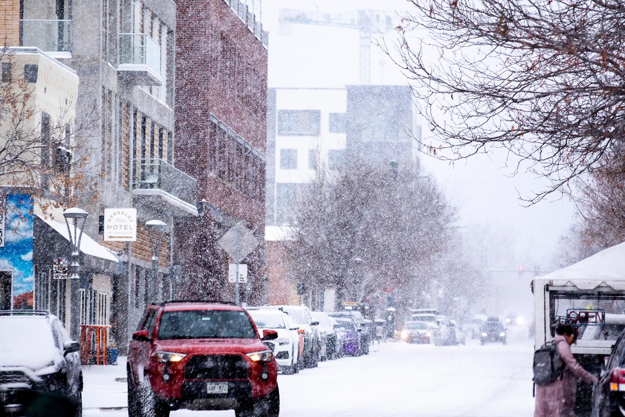
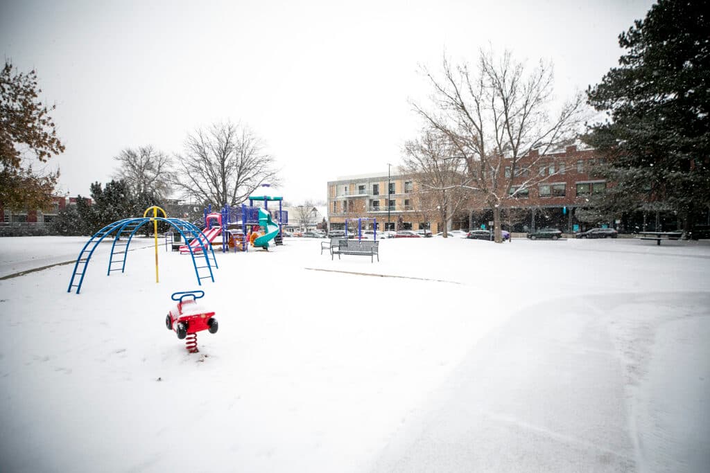
Denverites may have been under the impression that spring was in the air, but in true Colorado weather fashion, that was a lie.
From Wednesday night until Friday morning, temperatures will dip across Metro Denver and we’ll get a heaping of snow. About 8 to 16 inches to be semi-exact because those numbers may increase.
According to National Weather Service meteorologist Zach Hiris, Wednesday, March 13, will see a mix of rain and snow in the morning. That will change to full-on snow Wednesday night.
Most of the snow will fall on Thursday and will taper off Friday afternoon.
“We’re looking at kind of a long duration period of moderate heavy snow across the Denver Metro beginning sometime late Wednesday night or early Thursday morning and continuing through most of the day, Thursday,” Hiris said. “It’s going to be a long duration storm, especially up into the foothills but we're looking at widespread heavy snow across the region…It’s going to be quite the storm.”
Double digit snowfall is expected downtown Denver and in the south and western sides of the metro, so near Boulder and the Palmer Divide. East and northern Denver can still expect high single-digit numbers but overall, those numbers may increase as the storm comes in.
Similar conditions are expected throughout the Front Range, including in Colorado Springs where 7 inches could fall.
Though it's been warmer lately, spring dreams are often interrupted during this time of March, according to Greg Heavener, a NWS Warning Coordination Meteorologist.
Heavener said the second and third weeks of March are often “prone to big weather storms.”
“You look back, say the past handful of years, in 2019 March 13th the big bomb cyclone, Pi Day of 2021 we had two feet of snow in Denver Metro. Now we're looking at basically, a redo of that. Another Pi Day storm. Not the same magnitude but same timing,” Heavener said. “The 12th through the 15th of March are notorious for producing these big, low pressures across Eastern Colorado that usually end up giving us quite a bit of snowfall.
Heavener said one of the anomalies of this storm is that the system driving the storm is coming from southern California. Typically the March snow storms are driven by changes in northern New Mexico and southern Colorado. With the difference in system location, we’re getting a longer period of snowfall.
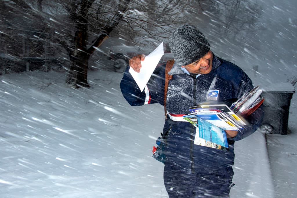
Heavener and Hiris said folks should prepare for a hard commute Thursday.
Their advice is to stay indoors and stay warm but if you must commute, equip your car with the essentials, such as a blanket, extra clothes and water. Dress in warm layers that are water-resistant.
“Pack your patience for sure because [traffic] will be going slow in a lot of spots,” Heavener said. “We always recommend folks check cotrip.org when it comes to road conditions and even closures because there might be some of those happening on Thursday. So basically kind of the whole knowing before you venture out if you absolutely have to go out. If you don't have to leave the house, don't leave the house on Thursday.”
Hiris said the weekend weather may be a bit milder and temperatures will rebound, but winter isn’t over. Snow may also fall in April. That’s just Colorado for you.
While some folks might be unhappy with the snow fall, the folks at NWS are ready for it. Heavener said it's "kind of like our Super Bowl in a sense."
“It’s really where we earn the trust of the public because it is going to be a high-impact, large-scale event,” Heavener said. “It can be exciting from a metrological standpoint. You kind of get to forecast the system and we hope the impacts are minimum. We hope there's no no damage or anyone getting hurt or injured by this system. Being a forecaster and communicating this, we want to make sure we're doing the best job we can and make sure people are well aware of what's expected, what impacts can be so that way they can help provide that life safety for themselves.”
And for those in need of shelter, the city will activate overnight shelters as well as warming centers.
From 6 p.m. Wednesday, to 9 a.m. Saturday, the McNichols Civic Center Building at 144 W. Colfax Ave. and the Stone Creek shelter at 4595 Quebec St. will be used as overnight shelter. Those in need should head to those locations directly. If individuals have a pet, they should go to the Stone Creek shelter.
People in need can also head to the city's "front door" shelter facilities, which have expanding capacity during cold weather nights. Those include Lawrence Street Community Center at 2222 Lawrence St. for individual men, Samaritan House at 2301 Lawrence St. for individual women and Urban Peak at 2100 Stout St. for youth ages 15 through 20.
For daytime shelter needs, all operating recreation centers will be used as daytime warming centers during regular business hours from Thursday to Friday. The city says "each center will have a designated area available for warming, with access to drinking water, restrooms, and a place to sit."
Though not designated as a warming center, all open Denver Public Libraries are also available for those who need to get inside from the cold.
Editor's note: This article has been updated with information about emergency weather shelters and warming centers.