A company that does lots of work in Denver's RiNo neighborhood just released a rendering of how the place might look in four years.
OZ Architecture compiled the image below with input from a dozen other design and development firms working in the area, according to a news release.
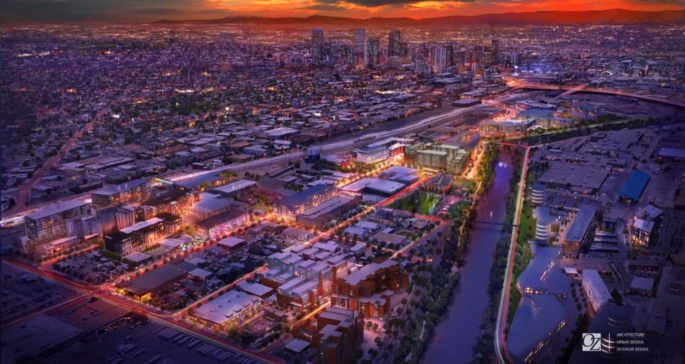
That's 38th Street running diagonal on the lower left side of the lighted area and the rail corridor on top, with Brighton Boulevard splitting the middle. Pretty much none of that shiny new development exists yet, except for Taxi, one of the long buildings on the right side of the river.
You can also spy a new pedestrian bridge across the South Platte, next to the planned RiNo Park on the left side of the river. (Check out a giant version of the rendering here, and a key that shows the names of all these projects.)
OZ is working on a crazy number of RiNo developments, almost two dozen in all, so this is obviously good marketing for them -- but it seems like an accurate (if nicely tinted) visualization of the place, so I thought it was worth sharing.
Here's how it looks today, from Google Maps:

Does this rendering look like what you want and expect from this area? Do you have a name besides "RiNo" for it? Tweet at me: @AndyKnny, or email [email protected].

