Colorado from space: Astronauts’ shots of Denver and the Front Range over the years

Let’s take a look at Colorado from space with these awesome astronaut-taken photos.

(Kevin J. Beaty/Denverite)

staff photo
From left, Cheyenne, Fort Collins, Greeley, Boulder, Denver and Colorado Springs. (Shane Kimbrough/NASA)

From left, Cheyenne, Fort Collins, Greeley, Boulder, Denver and Colorado Springs. (Shane Kimbrough/NASA)

Astronaut Shane Kimbrough apparently knows his Front Range geography. He snapped the image above from more than 200 miles high in orbit, capturing Colorado’s greater metro area, and tweeted it this morning. (Well, morning for us, who knows what time for him. Space time.)

Scroll on for more.

Denver at night from space. Full size available for free. (International Space Station/NASA/Public Domain)

Denver at night from space. Full size available for free. (International Space Station/NASA/Public Domain)

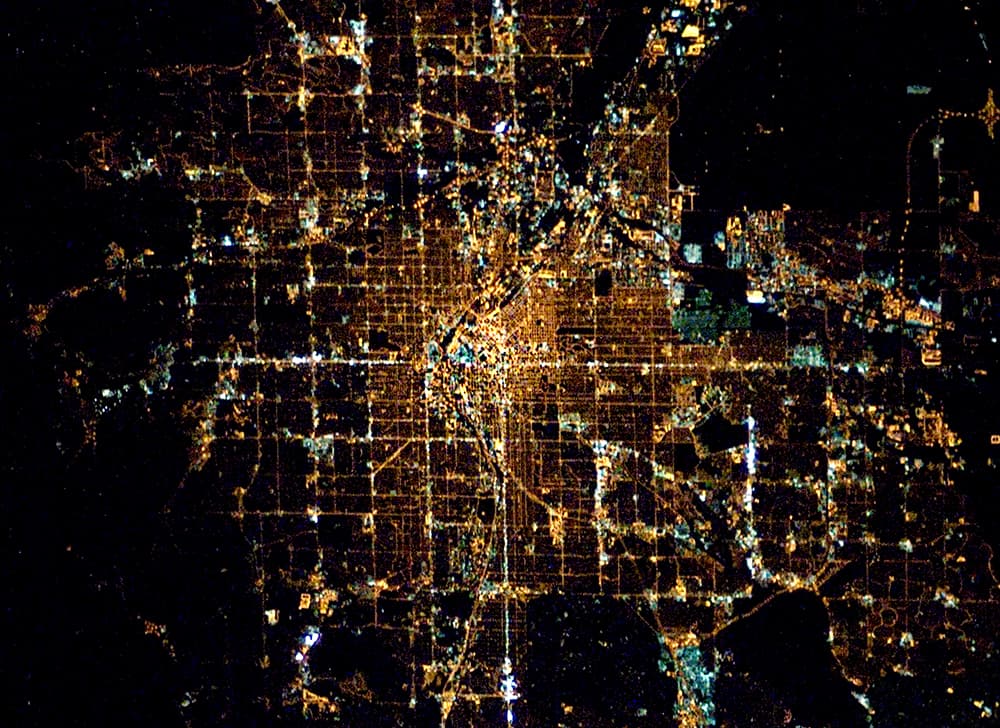
This one above is my personal favorite because, like the Blue Dot image, it captures most of our little lives in one image. I also like that it’s blurred and distorted in some parts, giving the impression that it really was taken by some folks just casually flying by in space. It was taken on from the ISS on Jan. 31, 2008 on a Nikon D1, a camera you could buy today for about $140.

Astronaut photography has become a very popular thing lately. Often enough, they use consumer SLR cameras with long telephoto lenses. It’s wild to me that the power of consumer electronics can deliver these images. (If I could get just get to space, my Canon could do this!)

It’s kind of like a musician on stage calling out to people from different cities. “I see you, Greeley, but I can’t hear you.”

Denver in snow from the International Space Station in 2002. (ISS/NASA)

Denver in snow from the International Space Station in 2002. (ISS/NASA)

A view of the Great Plains cities, labeled as including "Denver," from the International Space Station in 2011. (ISS/NASA)

A view east toward the Great Plains cities from Colorado. I believe Denver is at right. (ISS/NASA)

Another 2011 view east toward Kansas. My best guess is that we're looking, from left, at Cheyenne, Boulder-Denver, Fort Collins and Pueblo along the bottom edge. (ISS/NASA)

Another 2011 view east toward Kansas. My best guess is that we're looking, from left, at Cheyenne, Boulder-Denver, Fort Collins and Pueblo along the bottom edge. (ISS/NASA)

A view of the greater Denver region from one of the space shuttles in 1993.  (STS/NASA)

A view of the greater Front Range region from one of the space shuttles in 1993. I can't quite figure this one out, so email me if you can pinpoint any details. (STS/NASA)

The grand sweep of the West from one of the space shuttles in 1991. Grand Junction is at dead center, the Front Range is on the righthand side of the prominent mountain range. (STS/NASA)

The grand sweep of the West from one of the space shuttles in 1991. Grand Junction is at dead center, the Front Range is on the righthand side of the prominent mountain range. (STS/NASA)

Of course, unmanned cameras have also captured our fine metro from space, too. Check out the time-lapse images we compiled last year from satellite imagery.
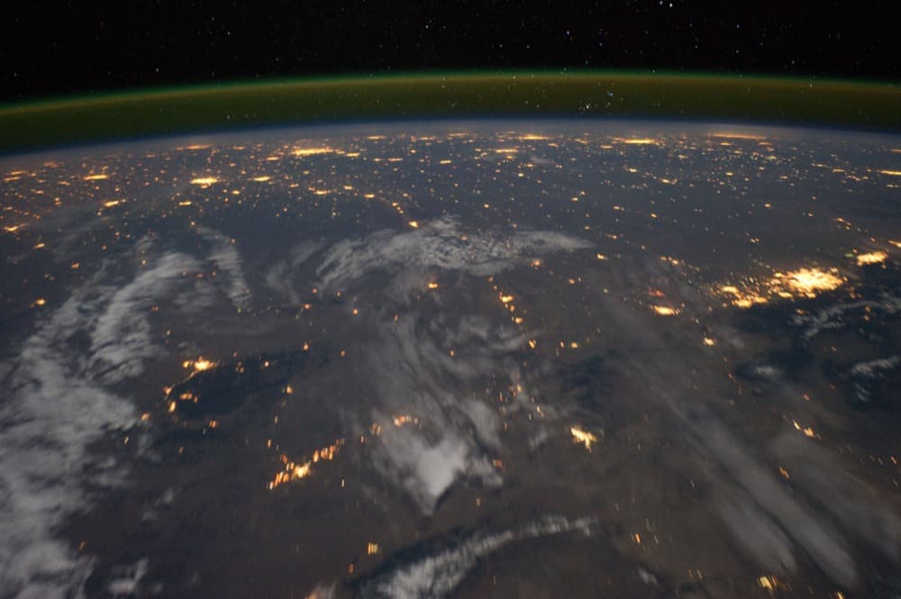
Also, this one doesn’t include Denver, but man is it a view:

And for more on space shooting technique, in case you end up there:

Weird times

Denverite is powered by you. In these weird times, the local vigilance, the local context, the local flavor — it’s powered through your donations. If you’d miss Denverite if it disappeared tomorrow, donate today.

You’re our superpower

Denverite supporters have made the decision to financially support local journalism that matters to you. Ready to tell your networks why? Sharing our “About” page with your own personal comments could really help us out.

You’re our superpower

Denverite members have made the decision to financially support local journalism that matters to you. Ready to tell your networks why? Sharing our “About” page with your own personal comments could really help us out.