Updated December 10, 2021 @ 9:20 a.m.
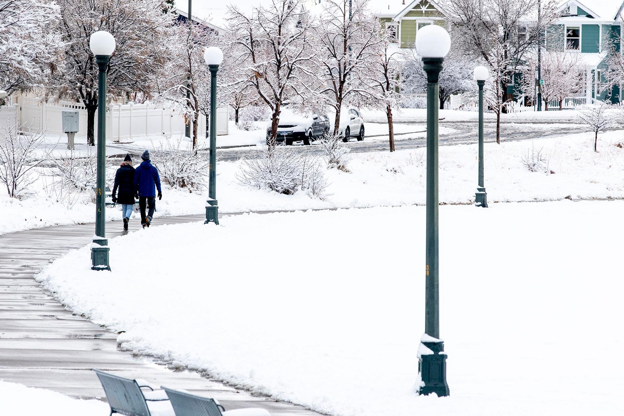
Downtown Denver finally broke its snowless dry spell Friday morning. By 6 a.m., a steady flow of flakes had covered parked cars and grassy areas with a light dusting.
A small amount of snow has fallen at Denver International Airport, the National Weather Service's official measurement location for the city. That means the city's 232-day stretch without snowfall is officially over, tying a disputable 1887 all-time record after already surpassing every other modern-day streak.
Unfortunately, today's winter weather likely won't add up to much. The NWS expects less than an inch of snow to fall around the metro area.
Strong winds and cold weather will stick around all day, however. The high is around 32 degrees.
But what does it mean?
Friday's flurry means the city has broken its streak without snow at 232 days -the same number as the previous record set all the way back in 1887. Record-keeping was less rigorous back then, so the record is disputable. However, Denver already blasted past the more modern record of 211 days weeks ago, which was first set in 1977 and then tied in 1992.
That's not to mention the 1934 record for the latest snowfall ever, which we passed back on Nov. 21. And neither of these personal bests cover the 230 (!) other heat records we broke in just the first three days of December.
Other strange stuff, like a surprise haboob earlier this month, coated the city in dust from Colorado's parched eastern half. Weird things have happened in our neighboring states, too. In Kansas late-season grasses didn't get the memo to stop growing and slurping up much-needed moisture.
Just because we got some snow doesn't mean we're out of the woods yet.
The longer-term consequences of this dry spell still aren't great, and will only get worse if they persist. Coloradans are already feeling the impact of a longer fire season, less mountain snowpack, and, of course, the stunting of our ski season.
Mountain snowpack is a big concern because it's how most Denverites get their drinking water. The warm temperatures mean more rain and less snow -- which is a problem because rain has the annoying tendency of running off rather than accumulating. There's still time to make up for the below-average early snowpack, but it's anyone's guess as to whether it'll happen.
The start to a warmer, drier winter in Denver is also tied to bigger climate events: La Niña is occurring for the second year in a row. The climate pattern starts by churning up colder water in the Pacific Ocean, pushing the jetstream north and bringing wetter conditions to the Pacific Northwest. This means that by the time storms roll over Colorado from the West, they've usually already lost a lot of their moisture.
So, the weird weather might not be over, but let's take a moment to rejoice in our much-needed snow.