Most Denverites of the 19th Century would never get a chance to see their city from the air, which may be why these crazily detailed aerial maps were all the rage.
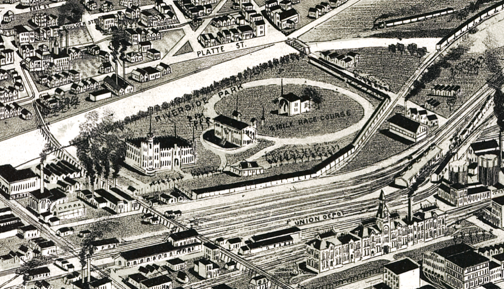
Union Station is pictured above, at the bottom right. It had a pretty sweet steeple, and, even then, a lot more rail lines than today. North of the rails, you can see the circle of a race course, part of Riverside Park. Riverside Park eventually was industrialized and later was replaced by Commons Park. The castle-looking thing on the left side of the park stands almost exactly where Stoner Hill does today. Across the river is the edge of Lower Highland.
Before we go on, here's the whole city
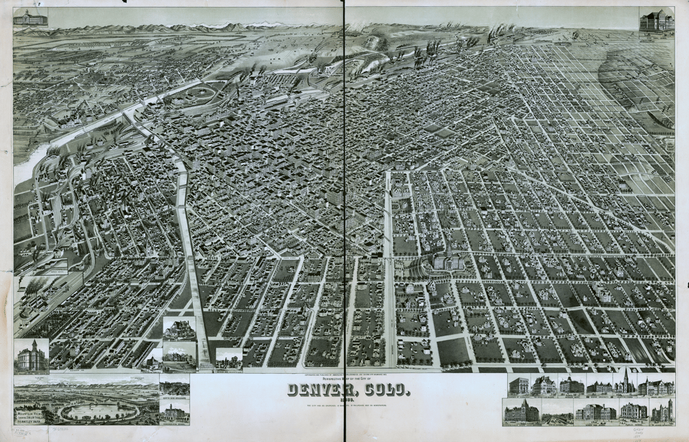
All of the images in this post are crops of this one giant map, provided by the Library of Congress.
It's known as a pictorial map, sharply detailed block by block, with perspective warped to fit everything together. They became popular at a particular moment in American history, when cities were engines of industry and opportunity.
People loved them. Every city had to have one, as detailed in Gizmodo:
On a map of Denver, dark smoke clouds bluster from trains that run alongside a gridwork of empty plots, just waiting for entrepreneurs to snap them up. A map of Newark shows the young city in the foreground, emphasizing the many roadways that lead to New York City, prominent in the background. Chicago's already dense rat's nest of railways and terminals are highlighted in fire engine red as they snake from Lake Michigan out into the Midwest.
These types of maps acted both as planning aids and advertisements. Some exaggerated the condition of the city to draw new visitors and investors. I’m not sure how much this particular map differs from what really existed, but it has landmarks in the right places and shows the differences between neighborhoods.
On to the rest of the neighborhoods.
Lower Downtown
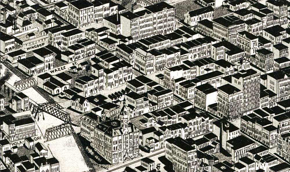
What was it like to hang out in the LoDo of 1889? A lot of drunk dudes with mustaches, I'm guessing. The architecture also looks pretty similar. I'm not sure why Wynkoop is spelled "Wincoop" here.
You can see the old City Hall here, bottom center, at present-day Larimer and 14th. All that's left, apparently, is an old bell.
Auraria
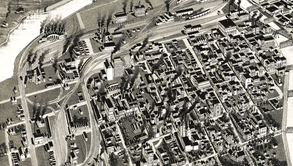
Lots of smokestacks here on the future campus of CU-Denver, which previously had been the independent town of Auraria. I couldn't find the historic Tivoli Brewery, but check out that sweet train stuff near the river.
Capitol Hill
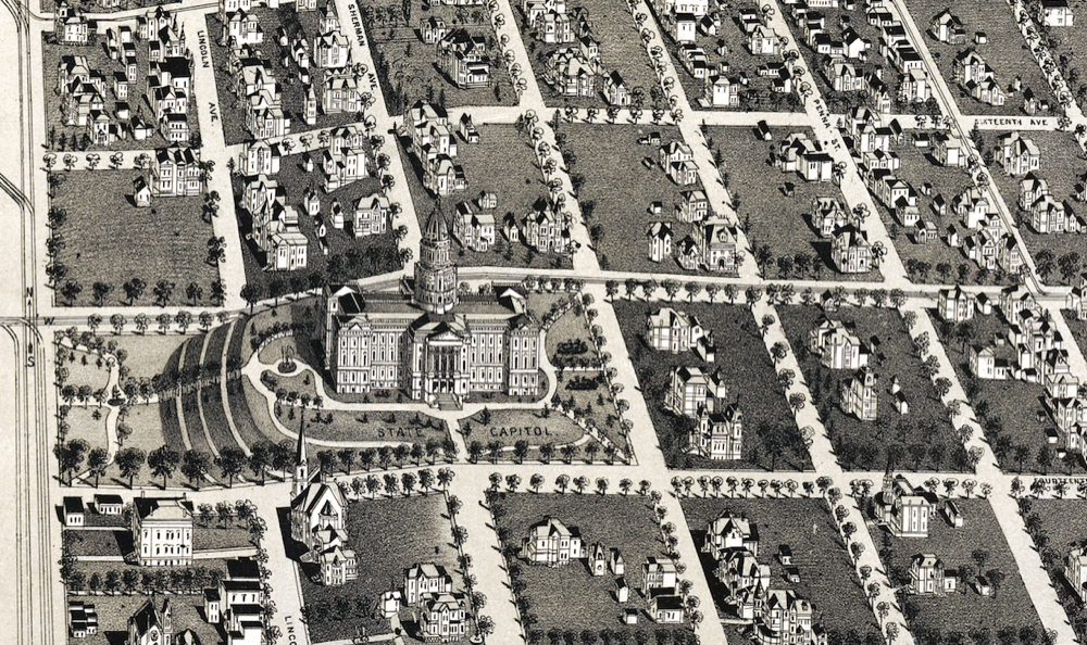
Note the trolley lines along Broadway to the west. Also, I appreciate that so many of the blocks around the Capitol are straight-up meadows with a couple houses in them.
Also, as an astute reader pointed out to me: The Capitol is facing the wrong direction! In reality, its length runs north-south. As our reader points out, the building was still in design when this map was published in 1889, and wouldn't be finished until 1894.
East Denver
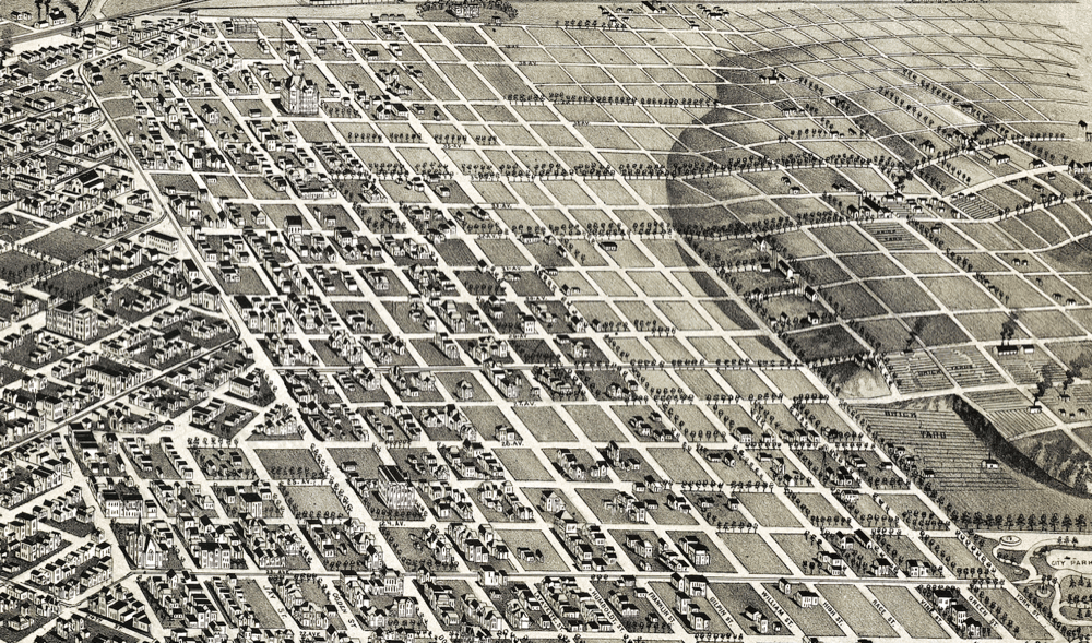
See that thing in the lower right corner, way out at the edge of town? That's the future site of City Park Golf Course, at York Street and 24th Avenue.
Highland
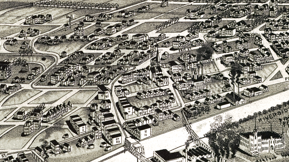
The 15th Street bridge crosses the South Platte River in the lower left-hand corner. Little Man Ice Cream's giant jug isn't old enough to be pictured here, sadly, but it would be just a bit north of Erie Street, pictured center-right here.
Do it yourself!
There are a ton of landmarks and neighborhoods that I've missed here. The Library of Congress has a fully zoomable and downloadable version of the map that you can explore. Some of the streets have been renamed, but you can generally cross-reference locations with a modern map. As you find stuff, please drop me an email to let me know: [email protected].