If you've tried cycling or walking around Confluence Park lately, you've probably found that your normal routes are all screwed up. That's because an unfortunate number of public and private construction projects have combined to obstruct the routes along the South Platte on both sides of the river.
We'll have to deal with this plague of orange detour signs for quite a while longer, so here are my best suggestions for modifying your routes along the South Platte River Trail, the Colorado Front Range Trail and Cherry Creek. If you pass through this area at all, I'd advise reading this.
(Update: See bottom of post for construction schedule)
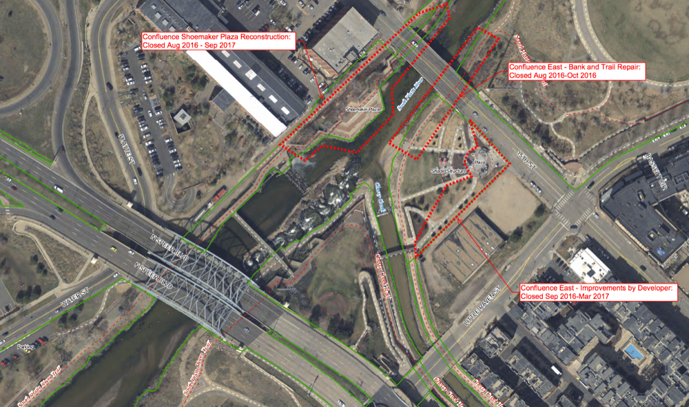
First, a map:
This is kind of busted because I made it myself,but hopefully it gives you the right idea. The red marks show where the trails are blocked.
Blue shows how to dodge construction on the Highland side, while pink shows how to get around on the downtown side and how to get on the Cherry Creek trail. I'll walk through the major obstructions after the map.
Navigating the Highland side of the river – blue route:
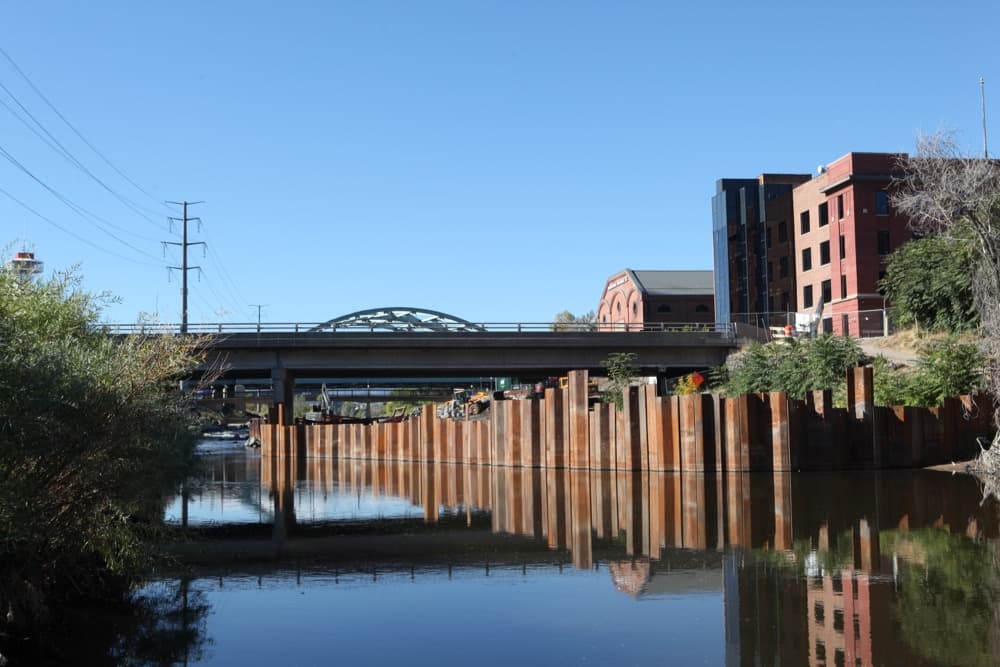
Construction delays for the remodel of Confluence Park have indefinitely shut down the trail near REI. That's a pretty easy workaround: Approaching from the southwest, you can detour around REI up to Platte Street, which you will then take past Natural Grocers.
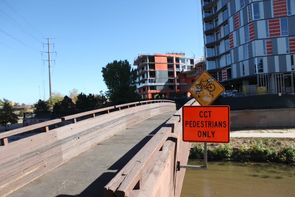
Once you reach the pedestrian bridges, you can cut right (back toward the river) to either return to the river trail or cross the weird tusked bridge into Commons Park and downtown.
Navigating the Lower Downtown side of the river – pink route:
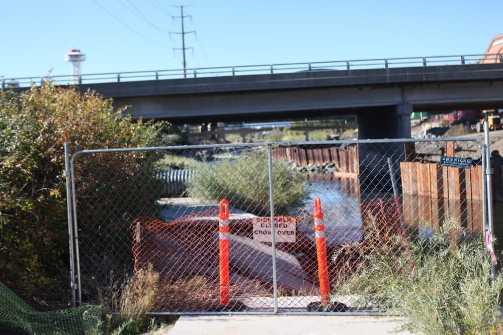
This side's pretty messed up right now.
Let's start with the northeast-to-southwest approach on the South Platte trail. The big problem is that you can't get directly from Commons Park down to Cherry Creek on a bicycle, and the cycling route across Cherry Creek also has been shut down by construction on the Confluence skyscraper.
Basically, that means that you're going to have to go completely around Confluence Park. If you're coming from the northeast, you'll have to exit from Commons Park onto Little Raven Street and follow it across 15th Street. That'll put you under the bridge with the murals, from which you either can get down to the creek or return to the trail.
When will it end?
This inconvenience is the result of a few different projects colliding, so different blockages will be resolved at different times.
Here's the city's expected schedule, explained below in text:
The stretch near REI will be closed through Sept. 2017, so you'll be making that Platte Street detour for a long time.
The underpass beneath 15th Street (connecting Confluence and Commons parks) is expected to reopen in October 2016.
The Confluence tower construction will continue through March 2017, according to the city. However, the upcoming reopening of the 15th Street underpass should mean you can bypass this pretty easily.