Spring is just a messed-up time of year in Colorado. I'm slowly losing the will to ski, and I know I want to get in shape for summer mountaineering, but the thought of snow and mud waiting around random corners makes me want to stay inside.
So, I decided to get some motivation by calling a couple experts. With their help, we've compiled this list of hikes for a range of ability levels, all within about an hour of Denver.
Some of these may require specialized gear, though nothing too expensive. Scroll to the bottom for more details on equipment and a special note about taking care of trails.
50 minutes from Denver: Dappled canyon exploration for all abilities.
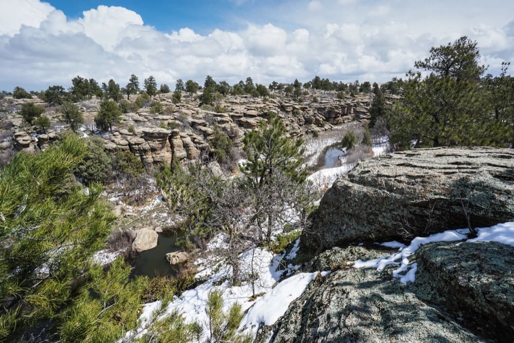
Let's start by going southeast to Castlewood Canyon, an interesting piece of geology. This one's going to be a good bet early in the season, since it gets tons of sun and it's low elevation.
You'll drive out of Denver and across the plains before you reach this great, rippling gash in the land near Castle Rock.
"You’re very surprised when you come across it," says Stephen Simon, publisher of GoHikeColorado.com, which I highly recommend. "Although I love to be in the mountains, it’s sort of a different type of hiking."
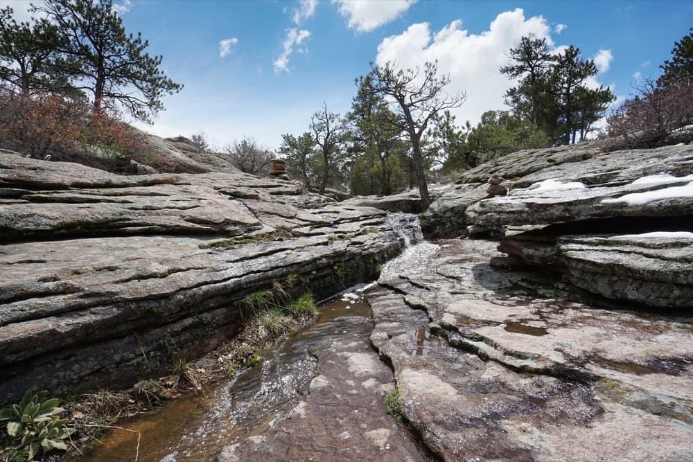
The hiking's "relatively easy," with little elevation change, Simon says, but the unusual terrain guarantees you won't get bored. A number of trails crisscross the park, and you can combine them into a 7-mile figure-eight route.
Trailhead: There are two entrances. The lesser traveled one is on Castlewood Canyon Road, south of its intersection with CO-86. (Google Maps.)
When to hike it: This should be accessible and fairly dry early in the spring, depending on the weather.
Gear: Nothing special – appropriate footwear, water, sunscreen and snacks.
30 minutes from Denver: Foothills frolicking.
These are pretty obvious, but they're worth mentioning. Jefferson County, just west of Denver, has an excellent network of trails on its open hillsides. They get plenty of sun and should be dry early. Plus, they're all very close.
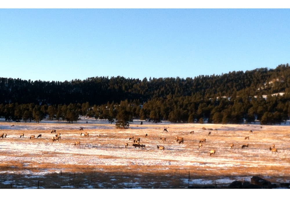
Elk Meadow - The dog park may be closed, but the rest of Elk Meadow Park is open and good for hours of hiking, just about 45 minutes from Denver. The rolling fields are gorgeous, and you may spot a herd of the namesake elk. There are about 17 miles of interlooping trails, making this a great spot to explore without too much planning. The trailhead is about 40 minutes from Denver at 32391 Stagecoach Boulevard and at 7557 Bergen Peak Drive in Evergreen.
Table Mountain(s) - North and South Table mountains are two impressive mesas that are practically on top of Lakewood and Golden, making them great for a quick morning hike or an after-work adventure. They should be bone dry after just a couple days of sunshine. Expect company.
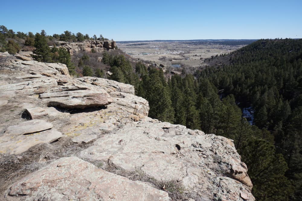
60 minutes from Denver: Rock formations and wildfire beauty in Pike National Forest.
By heading southwest to Pike National Forest, we can get dryer hikes that don't give up any grandeur, Simon says.
"The trails go through areas that are recovering from wildfires. There’s less shade, it’s a little bit warmer and you’re out in the sun for longer," he explains. "And also, the mix of spring vegetation, the burnt trees with the white-capped mountains in the background — it’s stunning."
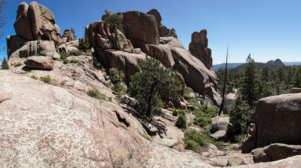
He particularly recommends a hike to the Chair Rocks. A ten-mile roundtrip from the trailhead will take you across open hills, through sparse pine forests and up to rounded rock formations above the South Platte River.
Trailhead: Pick up the Colorado Trail just south of Spring Creek Road and Deckers Road, south of the village of Buffalo Creek. (Google Maps)
You'll follow the trail northeast for about five miles to the rock formation. Check out Simon's guide for more detail.
Gear: The usual – water, sunscreen, a hat – and perhaps micro-spikes for your boots. More on that at the bottom of the post.
60 minutes from Denver: Snow-field sliding in Rocky Mountain:
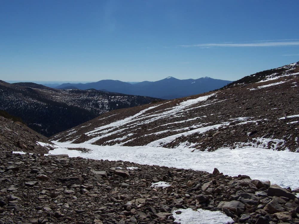
Alternate strategy: Embrace the snow. The early season is a good time to beat the crowds to St. Mary's Glacier in Arapaho National Forest, north off of Interstate 70 and just about an hour from downtown.
From the parking lot, a hike of less than a mile will put you above treeline and at the lake, which is nestled between "glaciers" – permanent snowfields, actually.
"It’s scenic," says Jeff Golden, communications director for the Colorado Mountain Club, a nonprofit that offers classes and training in outdoor recreation. "You can see Grays and Torreys peaks, Mt. Bierstadt and Mt. Evans. You have these expansive views for not that much effort."
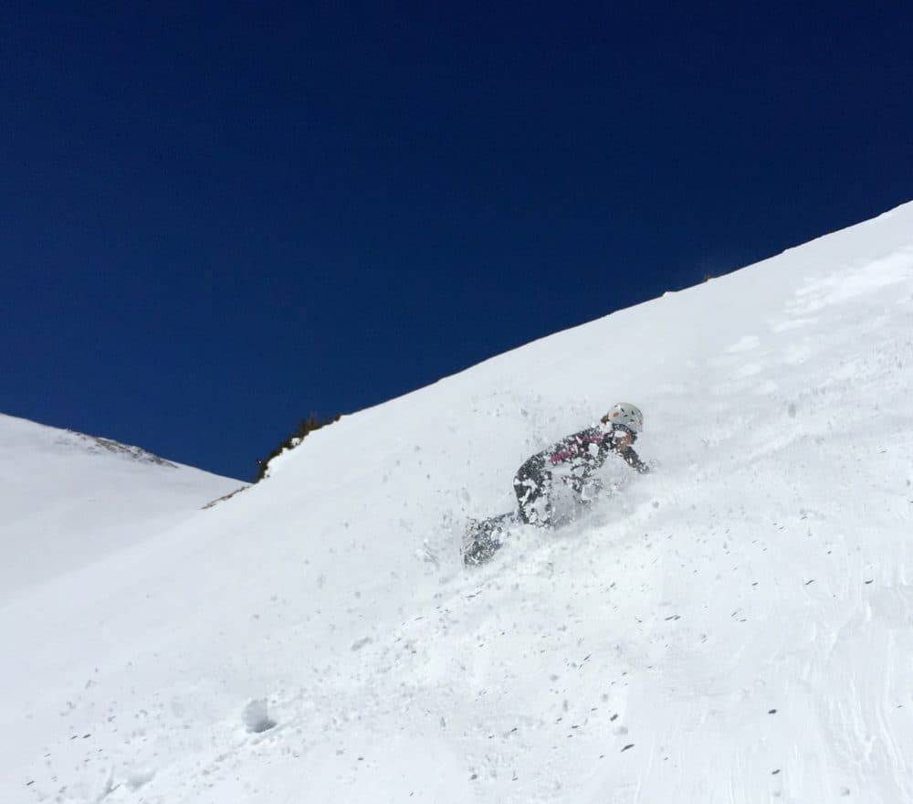
The real fun, though, might be in continuing up the trail onto the snowfield, which opens up to a moderately inclined open tundra.
"There aren’t any crevasses. You don’t have to rope up," Golden says. "A lot of people do it just with snowshoes and trekking poles." In fact, you could make it up in hiking shoes, though we'd really advise at least some kind of traction. (More on that later.)
Once on the snowfield, you can slide around, practice climbing techniques such as the self-arrest, or even ski down.
Trailhead: The hike begins just off Fall River Road, exit 238 on Interstate 70, just west of Idaho Springs. Bring $5 for parking, and mind you don't hit the morning ski rush. (Google Maps)
When to hike it: This is a high-elevation hike, with the snowfield around 11,000 feet, so expect to encounter snow and then mud fairly late into the spring. That said, you can attempt it early if you don't mind the conditions.
Gear: You'll at least may want to bring traction devices for your boots if you plan to climb the snowfield. More on that at the bottom of the post.
If you're determined to get to the top of the field, especially earlier in the season, then snowshoes and poles are recommended. However, the trail to the lake should be packed enough that you can at least get to the base of the snowfield with regular boots.
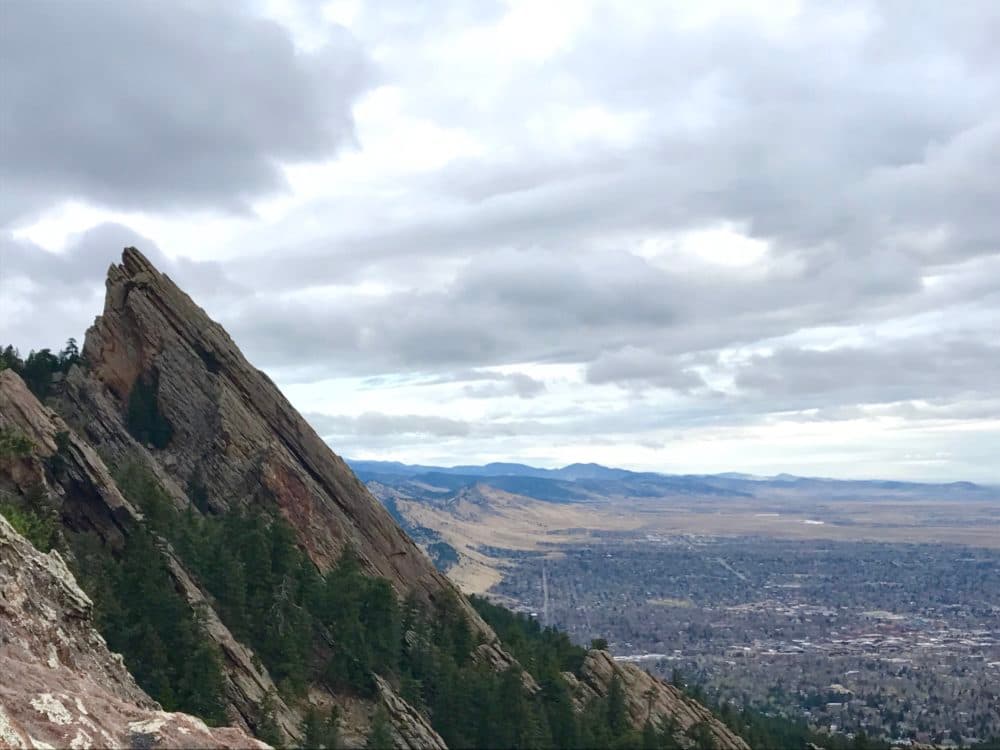
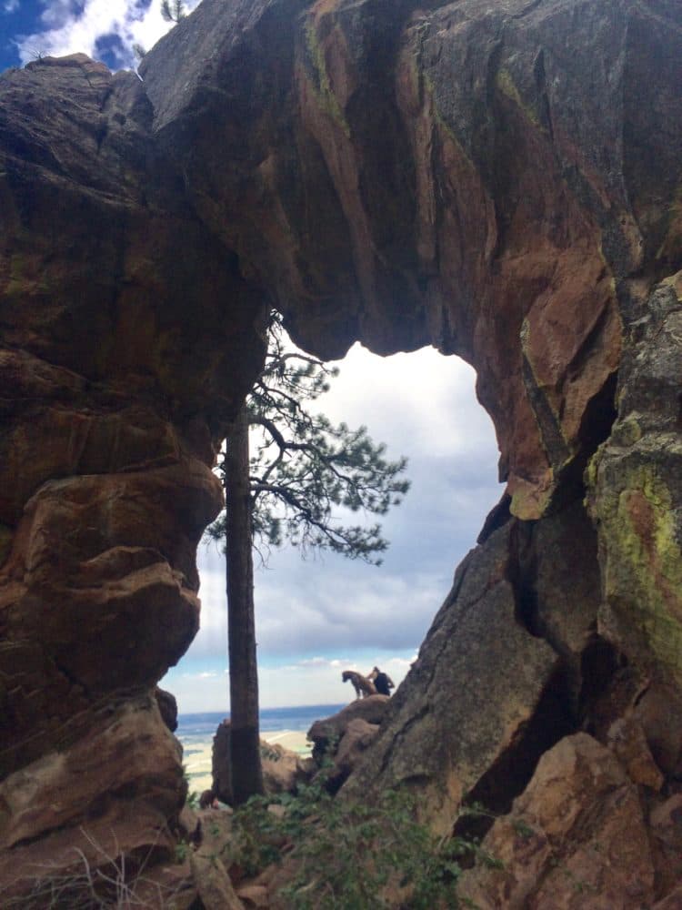
40 minutes from Denver: A challenging hike up to Royal Arch.
A popular Boulder spot where springtime might help you dodge the crowds. A straight shot off U.S. 36 and down Baseline in Boulder, the Royal Arch and Flatirons trails are easily accessed from Denver.
The Royal Arch 3.4-mile loop can get pretty crowded, but if you head up there early, you'll get some space and maybe see some deer.
It's not for the faint of heart or light of leg muscle. After some mellow strolling through the woods, you'll end up climbing up steep terrain with big, built-in rock steps.
As of late March, it was snow-free. The top offers views of the plains, Boulder, Denver and the Flatirons. (This one was by Ashley Dean.)
Trailhead: Chatauqua Park Trailhead, Grant Place and Baseline Road. (Google Maps)
When to do it: Should be good already!
Gear: Standard hiking stuff.
45 minutes from Denver: Miniature canyoneering.
Let's head back to Castle Rock for a tucked-away little spot. Simon says he's had good luck dodging snow in Mitchell Creek Canyon, just outside the suburbs.
"You start exploring a 300 or 400 foot deep canyon that is mostly slick rock," he says. "It weaves through some scrub and pine forest. You get a great view east to the plains of Douglas County."
Expect to get about three miles of out-and-back hiking out of this one. Nothing too crazy, but a good jaunt, especially if you're in the area.
Trailhead: It's probably easiest to start at Founders Park in Castle Rock. You'll follow a paved trail northeast out through the suburbs and toward the canyon. More detail on GoHikeColorado, as it may be a little tricky to navigate the developed section.
When to hike it: Anytime.
Gear: Just the usual.
60 minutes from Denver: A 13er off Loveland.
Let's wrap up with another more challenging introduction to winter mountaineering with Mt. Sniktau, a 13er.
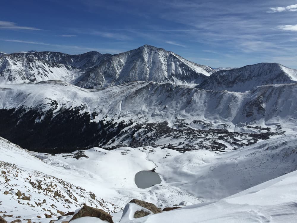
"If somebody wants an easy alpine experience, off Loveland Pass there’s a hike called Mt. Sniktau," says Golden. "The hike requires slightly less than 2,000 feet of elevation gain over four miles. ... The views are really spectacular."
Much of the hike is over snow, and it's a good bit of elevation, but the route is fairly simple. This can be accomplished with basic orienteering skills (bring your map and compass) and some low-level snow gear.
From the Loveland Pass lot, you'll take a rock staircase up to the Grizzly Peak trail, followed by a somewhat brutal climb up the eastern ridge. At the top, you'll hang a left toward Sniktau. (More details here.)
The trail may not always be clearly marked in snow, so make sure to stay safely on the ridge line, as a hanging cornice of snow can develop at the edges.
"It’s pretty obvious as far as route-finding right now," Golden says.
Trailhead: Loveland Pass Parking Lot. (Google Maps) Parking is limited.
When to hike it: You're going to run into snow through much of the season, but there will be more earlier, obviously.
Gear: Warm layers, ski goggles, micro-spikes for the bottom of your boots and gaiters to keep the snow out of your boots. (More on that later.) Compass and ideally a map for navigation. It gets windy!
One important message:
Sooner or later, you're going to run into mud. Your instinct may be to walk around. Do not do that. Walk through the mud.
"You’ll see a lot of areas where there’s a muddy trail and people go off to the left and the right. It’s really damaging to the alpine ecosystem," Golden says.
Walking off trail to avoid mud can widen the trail, worsen erosion and generally violates the "leave no trace" ethic.
About that gear:
Buying a set of traction devices for your hiking boots will greatly open up your possibilities. Yaktrax are just $30. Golden prefers the Kahtoolah MICROspikes, which cost $70 and also strap onto your boots. Both devices will give you traction on packed snow and icy surfaces.
If you're planning to go into the higher elevations, snowshoes and poles are advised.
In both cases, gaiters are advised. Gaiters tighten around the top of your boots and your pants, creating a seal against snow.
Any suggestions?
Email me with ideas for this piece or for the next item in our travel and exploration series.