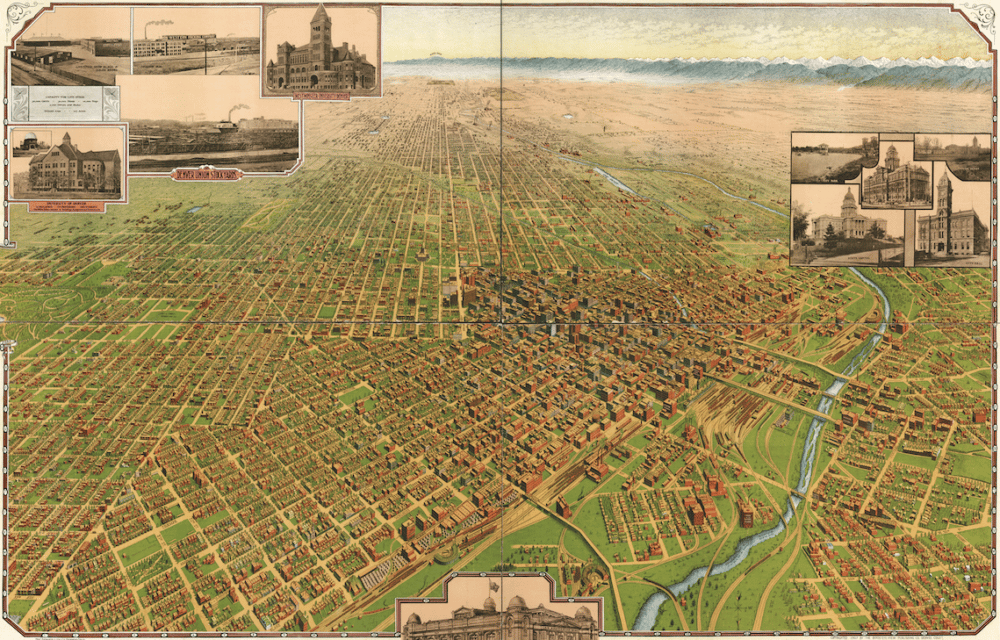
One of the very first things we published on Denverite was a post about the "Google Maps of 1889," a series of aerial images from a beautifully illustrated map of Denver.
Now it's time for the sequel. I've taken a couple of hours to examine a colorful pictorial map from 1908, a painstakingly crafted document that captures Denver just ahead of World War I. It was an age when our modern landmarks were just beginning to emerge, when blocky buildings had finally filled the city's core and tight-packed homes had marched out into the suburbs.
You'll see all that and more if you would just keep scrolling. Here's your tour of The Birds' Eye View Publishing Company's view of Denver in 1908.
Union Station:
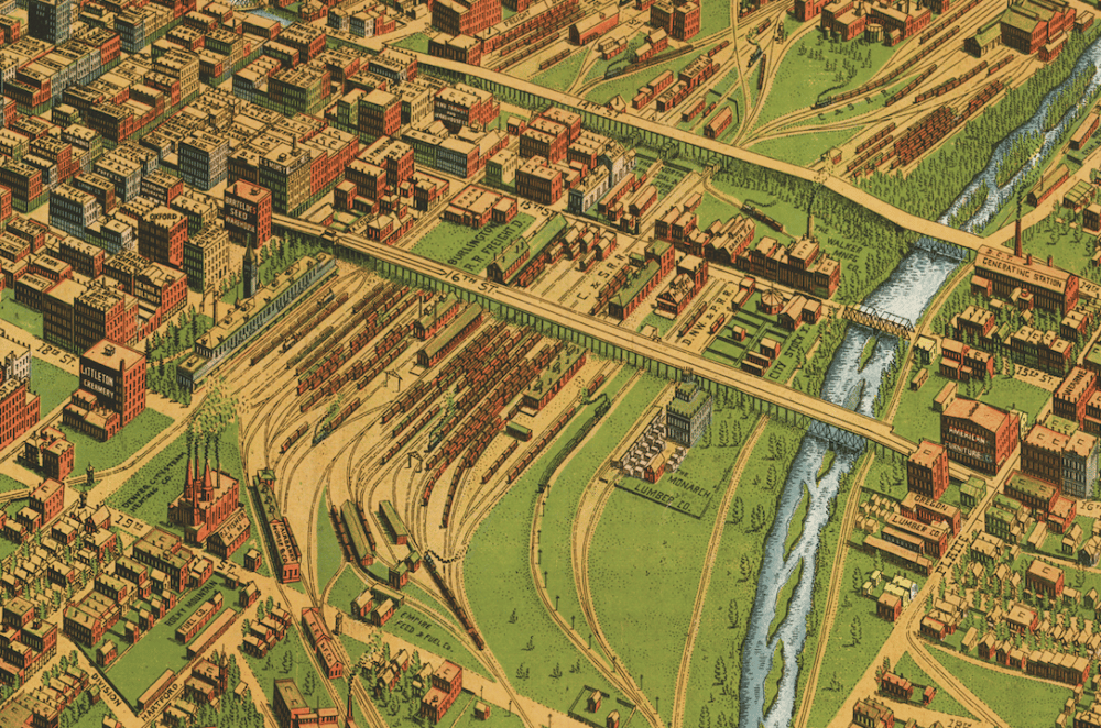
You know all those new "luxury" apartments that just popped out of the ground behind Union Station? That whole area was railyards until the late 1980s. I particularly like the detailing of the South Platte River here. Also, note the viaducts that let people cross from Highland into downtown. (We wrote a feature about the viaducts, too.)
Cap Hill:
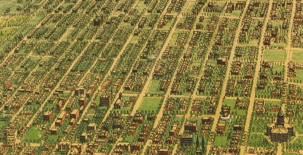
Alright -- Capitol Hill's starting to find its groove by now. Single-family homes have filled in most of the blocks, and you've got a number of multi-floor buildings on the north end. (The map's perspective faces south.)
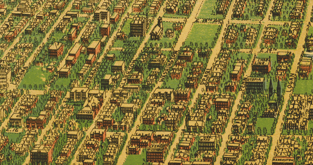
Let's zoom in a bit:
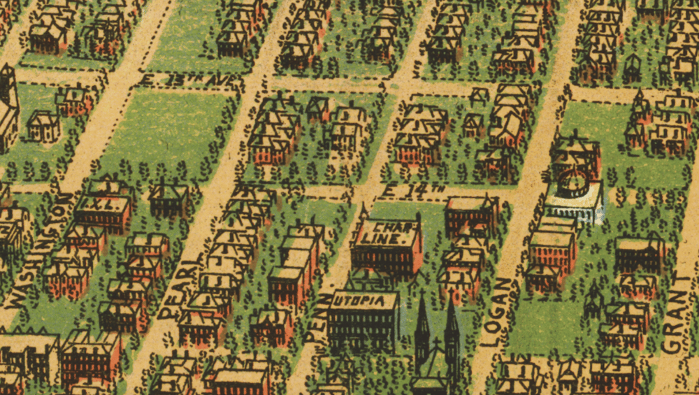
Colfax Avenue is at the bottom. The church near Logan Street has been demolished. The Molly Brown House would be on Pennsylvania between 14th and 13th.
And if we pan north a bit, we can see Uptown.
Auraria:
There's the Tivoli brewery at center left. Elitch Gardens would stand just slightly off the right-hand edge, in the railyards.
Auraria once had stood as an independent settlement, but merged with Denver in 1860 and quickly became what the Denver Library describes as a true "mixed-use neighborhood," where "(m)ills, breweries, warehouses and other commercial enterprises sat alongside homes for working-class and middle-class families and rooming houses for single working men."
What I love about these maps is that you can clearly see the character of each part of the city. The producers and illustrators must have walked blocks upon blocks of the city and filled in the rest based on popular architectural styles and city records.
Sun Valley:
Modern Mile High stadium stands about smack-dab in the middle of this one. In 1908, though, the South Platte River and the railyards kept this area cut off from much of central Denver.
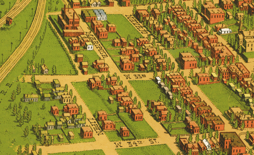
Highland:
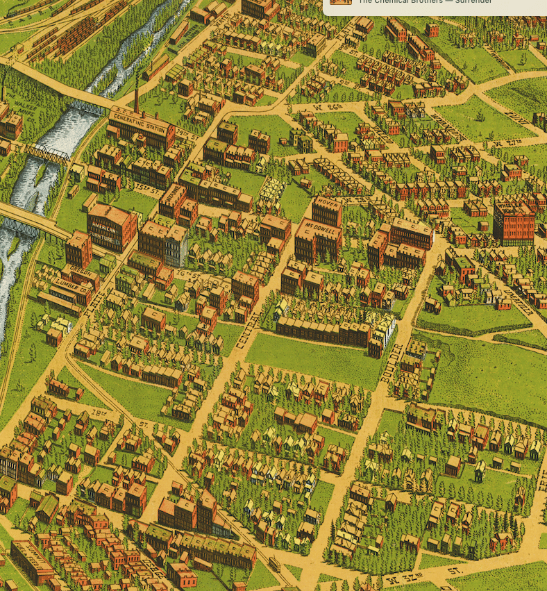
Highland got the deluxe treatment on this map, thanks to the perspective. Unfortunately, the map cuts off at the right edge of this image. Obvious landmarks include the REI building, which was built in 1901 as the electric generating station for the streetcar system, at top left. I'm pretty sure that building just below it still says "American Furniture Co" in real life, too.
Let's also pan a little bit down/northeast too, just because I love these little square houses and the attention the artist gave them. Cute.
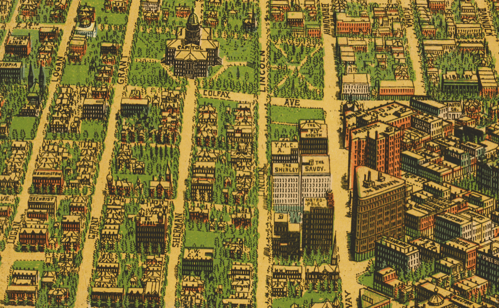
Downtown:
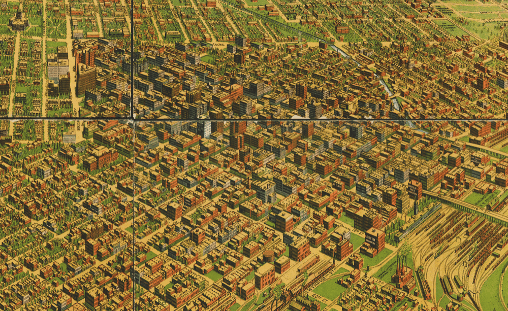
Quite the urban spread when you put it all together, with the Capitol at top left. Denver's population at the time was about 211,000, compared to nearly 700,000 today. Isn't this color scheme so pleasing? This appears to be a lithograph print, judging from the Library of Congress records on it, and they would have been working with a small palette of colors.
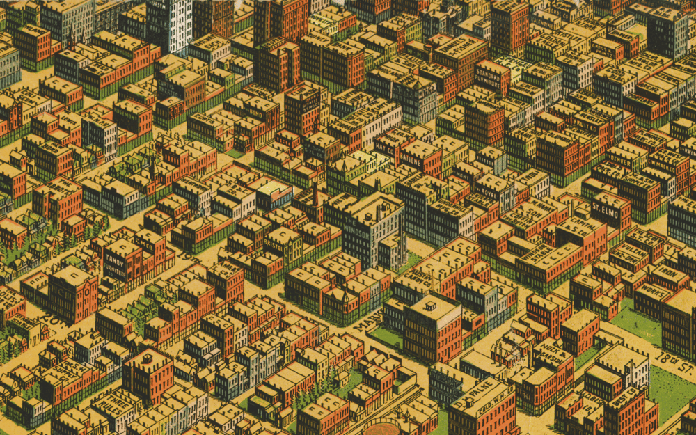
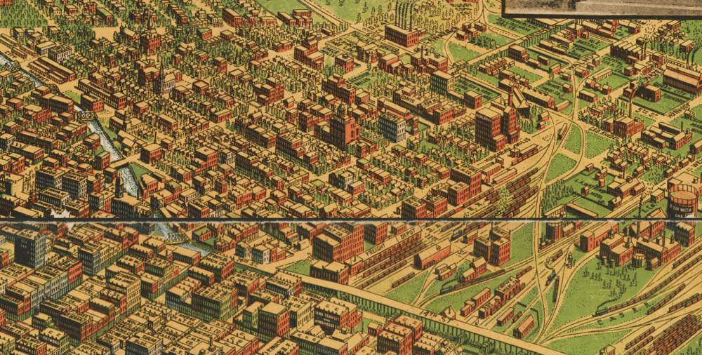
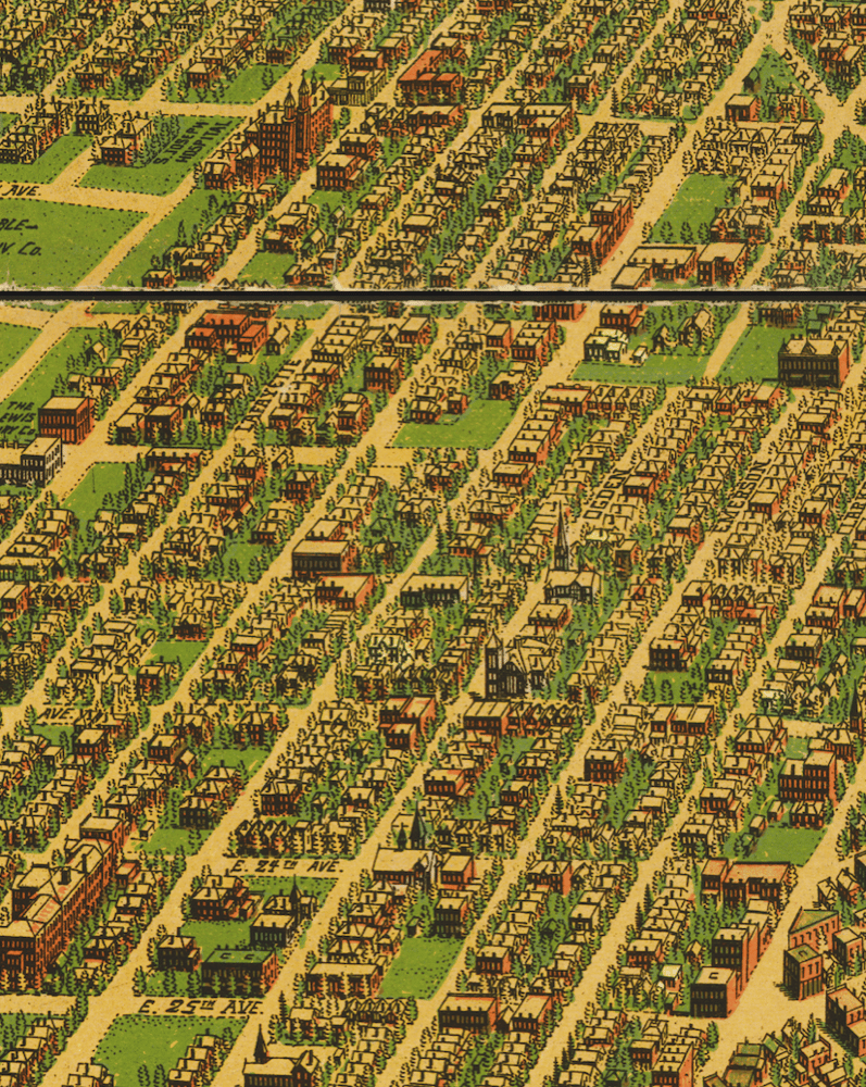
Five Points:
This crop shows just how finely detailed these pictorial maps could be. At the time, they were the only way that your average person could ever get an aerial view of a city -- short of a hot-air balloon trip -- so you have to imagine the sense of wonder they'd strike when done well. Also, the building at the bottom corner of the intersection, 2701 Welton Street, still stands today. (Read about the redevelopment of Five Points, a historically black neighborhood.)
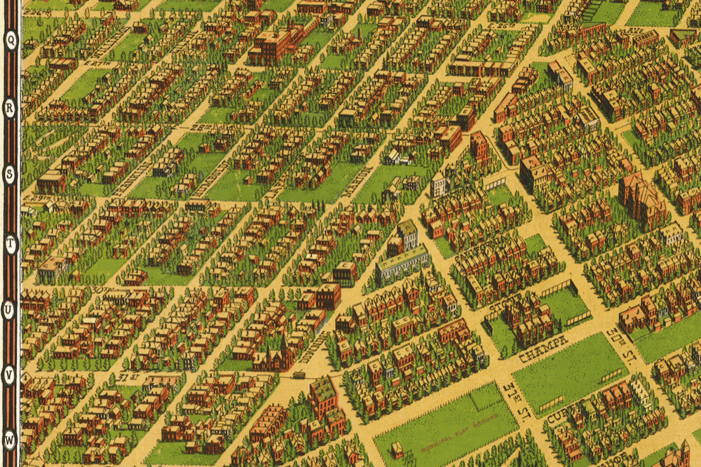
Here's a crop with more of Whittier at left. For reference, that's the future Mestizo-Curtis Park at lower right. Also, note the tiny little streetcar running along 31st across Downing.
And a view with more of southern Five Points:
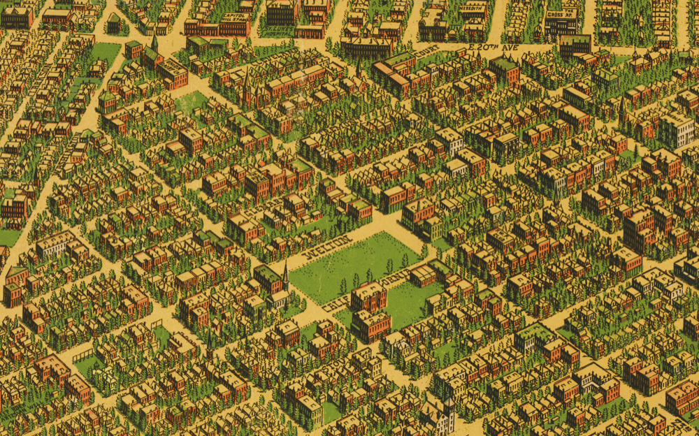
Congress Park:
I added this one after a couple of requests from readers. As you can see, things really start to peter out as you reach down toward 8th Avenue or so – but the beginning of Congress Park was definitely underway here, just south of City Park.
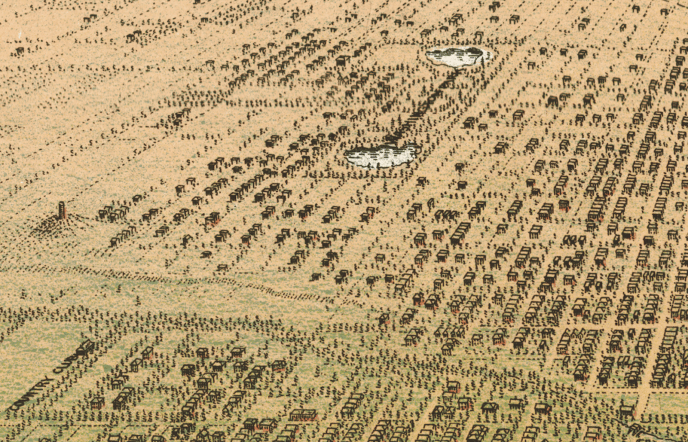
Cheesman Park:
Sorry, Chessmanites. You lived in tiny little half-colored ghost houses. Interestingly, the paths of the park still follow this same pattern. That also appears to be the future site of the Denver Botanic Gardens protruding left from Cheesman.
Union Station North:
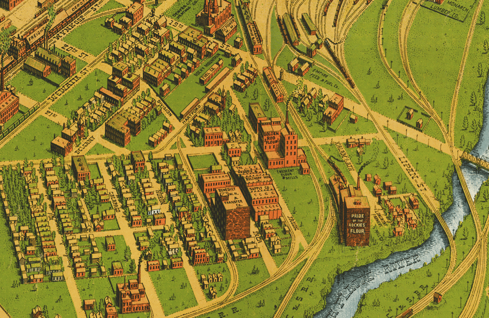
I know there's not actually a neighborhood called Union Station North, but developers like to brand it this way. The "Golden Rod Flour" building just right of Jason is now the Flour Mill Lofts -- condos, of course. Basically everything else has been destroyed. The only historic building I know of in that area is the one that houses Whiskey Tango Foxtrot, and I can't find that on here.
Colfax:
East Colfax is the second horizontal street from the bottom, and we're looking at an area just east of the Capitol. The Fillmore Auditorium now stands at Clarkson and East Colfax. There obviously was some density already, but it certainly doesn't look to be the neon-lit commercial strip of today.
Golden Triangle:
No museum district yet -- but the U.S. Mint already was in operation at center-bottom in this clip.
Lincoln Park, Baker and points southwest:
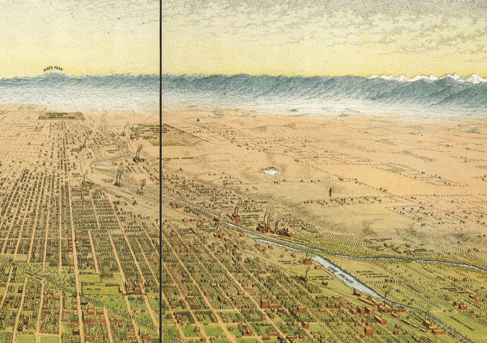
This is one of my favorite clips from the map. Pikes Peak is in the distant background. Lake Archer, foreground right, was a holding pond that drew water off the South Platte for James Archer's Denver City Water Company.
"Not a trace remains of the large holding pond that stretched from near Alameda Avenue to Seventh Avenue," according to Across the Creek. It straddles modern-day Lincoln Park and Baker, right around where Osage Street is today.
As we zoom in, you can pick out Santa Fe. It's not labeled, but it's just right/west of "Inka," now Inca Street. Just like today, there's a lot of action clustered around 10th and Santa Fe.
City Park:
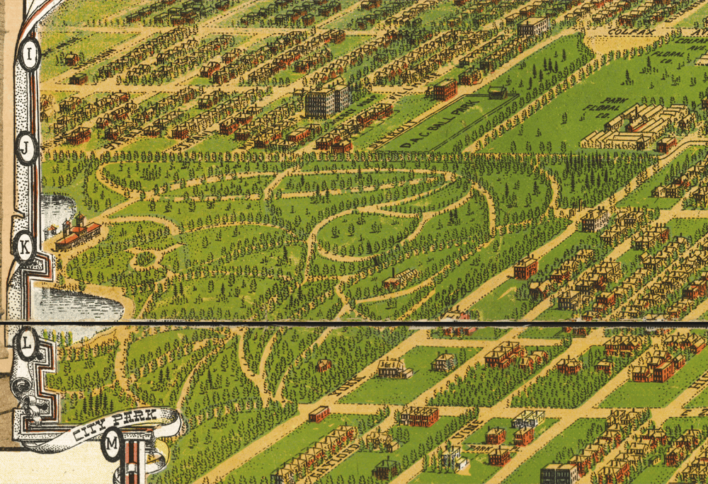
Here's the edge of the big park itself, complete with the City Park Pavilion building. Mercy Hospital is the grey building at top center of the park.
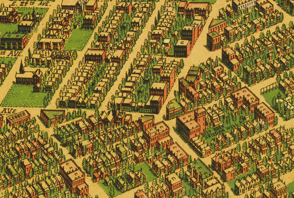
City Park West:
Here we've got a healthy section of City Park West. The Whittier school is at bottom left, touching 24th, 25th and Downing. Also, see the church at 22nd and Ogden, just about the center of the image? (You'll have to count streets.) That's been turned into a $1.9 million residence. The illustration doesn't exactly match what really stands there, but the dates and location match.
You can also see tiny little St. Joseph Hospital at the top-left.
Washington Park:
Not a lot of detail on it, but you can barely make out the "Washington Park" label between the park's two lakes. Also, is that a grain silo at bottom left?
OK -- want to do it yourself?
First, if you've got corrections or requests for neighborhoods I skipped -- or maybe if you spotted some funny little details -- then email me.
And then, if you want to explore more yourself, head to the Library of Congress page for this image. You can browse and zoom from the site, but I'd recommend downloading the full-sized .tif for maximum satisfaction.