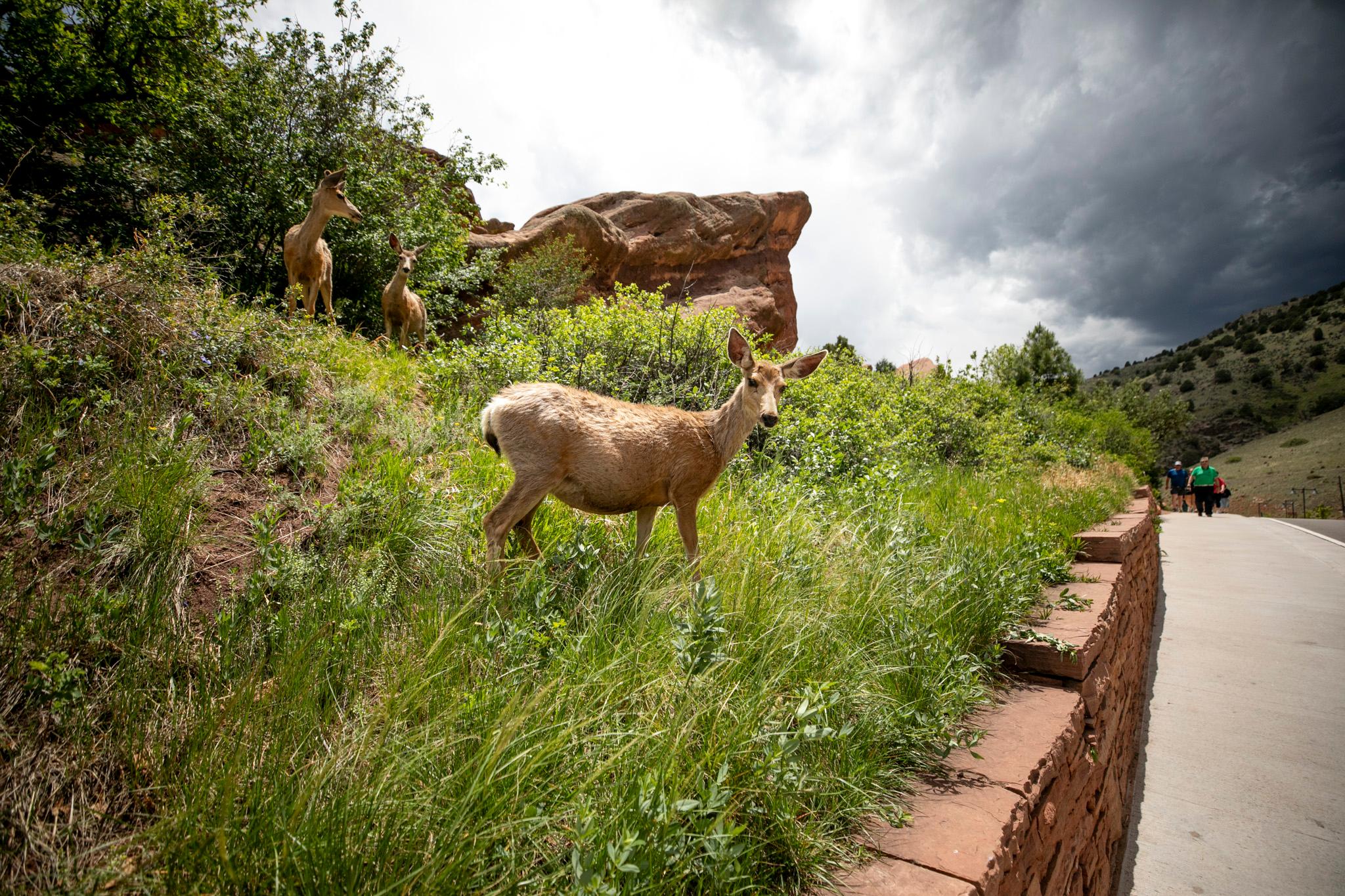
Summer officially starts next week, and with it comes the season of hiking -- of walking aimlessly through the geography that looms over our lives here in Denver. The days feel like they can last forever, but of course that's not true. There are only so many weekends in the season (14, officially), and there are countless thousands of miles to explore.
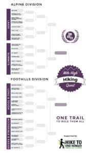
In the interest of narrowing it all down, we're launching a new project today: the Mile High Hiking Quest, sponsored by Hike to End Hunger. It's a March Madness-style bracket stocked with 32 classic hikes in Colorado. Over the course of five rounds of voting, we'll narrow it down to the one true hike.
That's right: We're going to find the best hike. Or maybe some people will vote to eliminate their favorite hikes, hoping to keep them secret. Either way, we hope you'll take a look at this incredible set of trails and join us for a conversation about what makes a journey truly great.
(UPDATE: The winner was Bear, Nymph, Dream, Emerald, Haiyaha!)
And here are the hikes!
ALPINE DIVISION:
Lakes Conference
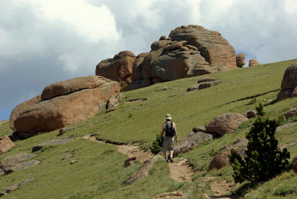
1. Sky Pond
- Distance from Denver: 2 hours; 82 miles
- Locale: Rocky Mountain National Park
- Type: Strenuous uphill
- Objectives: The name says it all: An ascent to a crown of the national park. See two waterfalls and the beautifully named Lake of Glass on your way up to Sky Pond. It’s a busy trailhead, so get there early.
- Length: 9+ miles roundtrip, 1650 feet vertical
- Trailhead address: Glacier Gorge Junction Trailhead, Rocky Mountain National Park
- More info: Day Hikes Near Denver
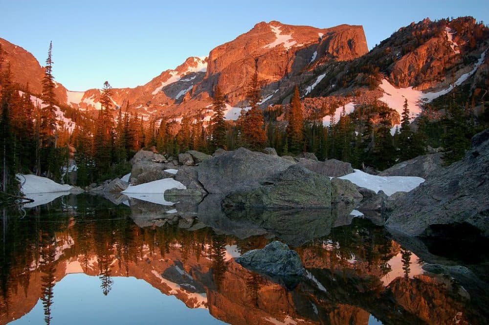
2. Bear, Nymph, Dream, Emerald, Haiyaha
- Distance from Denver: 2 hours; 84 miles
- Locale: Rocky Mountain National Park
- Type: A leisurely but solid lake-y loop
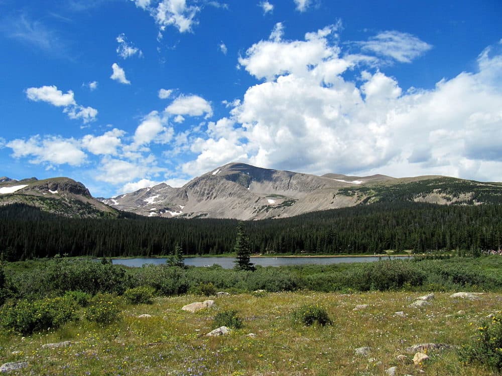
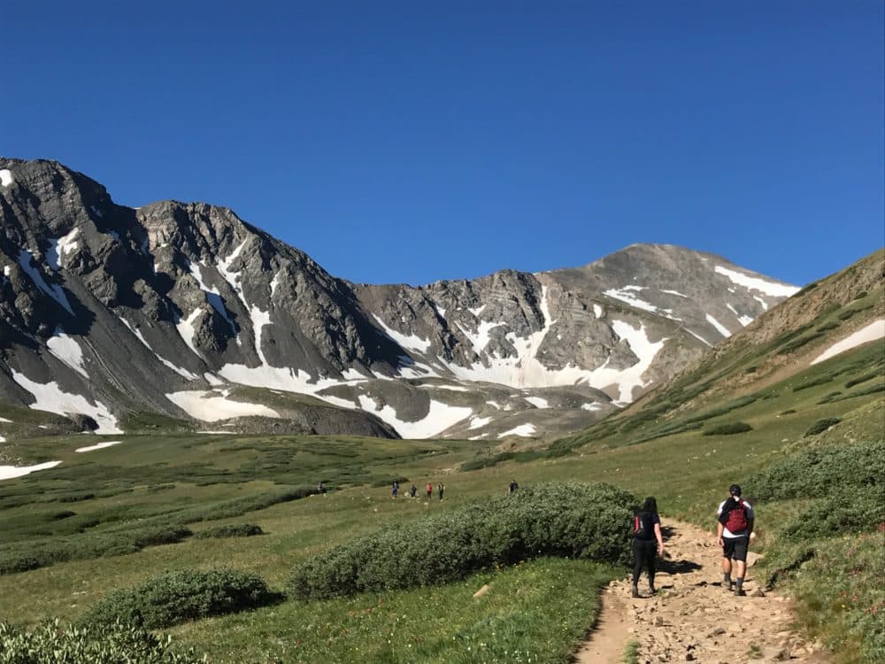
- Objectives: Visit five gorgeous lakes and ponds in just a few hours. Lake Haiyaha shimmers green, with enormous boulders on its shore providing prime relaxing spots and incredible views up Chaos Canyon. You also can limit this hike to Bear Lake, or try RMNP’s Sprague or Lily lakes for a more accessible experience.
- Length: 4+ miles roundtrip, ~800 feet
- Trailhead address: Bear Lake Trailhead, Rocky Mountain National Park
- More info: ProTrails
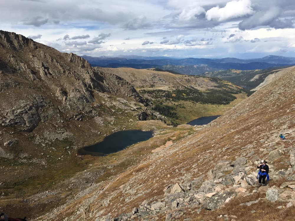
3. Chicago Lakes
- Distance: 1 hour from Denver; 45 miles
- Locale: Mt. Evans area
- Type: Day hike with a big ascent.
- Objectives: Climb up from the forest into an alpine valley, passing a burned forest and the lower lake before clambering over the final ascent to find a deep blue gem nestled between high rock walls. If you enjoy this one, Beartracks Lake trail is a great follow-up in the same area.
- Length: 10 miles out and back, ~6 miles if you continue to the Summit Lake parking lot. 2,000-plus feet of vertical.
- Trailhead address: Echo Lake Park, CO-103 & Mt Evans Rd, Evergreen, CO 80439
- More info: ProTrails
4. Arapaho Pass and Lake Dorothy Trail
- Distance: 90 minutes; 54 miles from Denver
- Locale: Mountains outside Nederland
- Type: Moderate, long climb.
- Objectives: Start at the Fourth of July Trail -- but be warned that it gets crowded, and the road isn’t great. Climb through woods and fields of wildflowers into alpine territory.
- Length: 7 miles out-and-back, 2,000 feet of vertical
- Trailhead address: Fourth of July Trailhead, 4th of July Road, Nederland, CO
- More info: ProTrails.
5. Brainard Lake to Blue Lake
- Distance from Denver: 90 minutes; 60 miles
- Locale: Indian Peaks Wilderness, northern Front Range
- Type: A shorter hike to an alpine lake
- Objectives: Visit the large, subalpine Mitchell Lake on your way to the appropriately named Blue Lake nestled high in the mountain peaks, with a sweeping view of the valley below. “Beautiful, feels like you’re really deep in the mountains,” one reader suggests.
- Length: 5.1 miles out-and-back, 800 feet of elevation gain
- Trailhead address: Access is $11 per vehicle, and the road is closed through June 28, 2018. Brainard Lake Recreational Area, Brainard Lake Road, Ward, CO
- More info: ProTrails
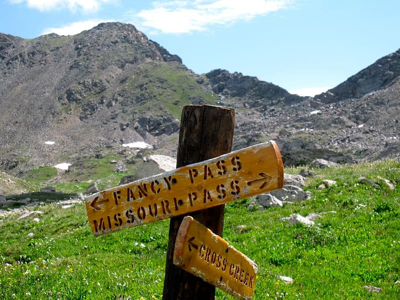
6. Fancy Pass and Missouri Pass
- Distance from Denver: 2.5 hours; 127 miles
- Locale: West of Leadville
- Type: Alpine loop with multiple lakes
- Objectives: First, you get to say you conquered FANCY PASS, which sounds a lot like “fancy pants.” If that’s not good enough, you’ll be climbing through forests and alpine landscapes to visit several lakes and tarns. Consider combining this with the 14er Mount of the Holy Cross for a weekend trip, or limit your hike to Fancy Lake or Missouri Lake for a shorter hike.
- Length: 9 miles roundtrip, 2,700 feet vertical
- Trailhead address: Fancy Pass Trailhead, Forest Road 727, Minturn, CO
- More info: ProTrails
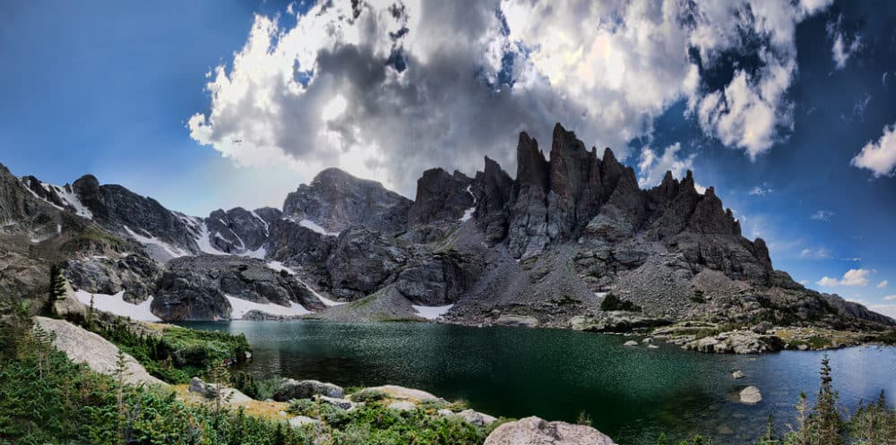
7. Gibraltar Lakes and St. Vrain Glaciers
- Distance from Denver: 1.5 hours; 70 miles
- Locale: Roosevelt National Forest, south of RMNP
- Type: An alpine lake tucked in the backcountry.
- Objectives: Hike up along the Middle St. Vrain Creek from Camp Dick, up toward the mountainous bowl where two emerald pools shimmer beneath the St. Vrain Glaciers. You can also take trails to Red Deer Lake trail and the summit of St. Vrain Mountain in this area. This could be an ideal spot for an overnight.
- Length: 14 miles out-and-back, 1,800 feet of vertical. You can cut some miles by driving on a 4WD road for the first segment.
- Trailhead address: Camp Dick, Middle St. Vrain Road, Lyons, CO
- More info: ProTrails
8. Herman Gulch to Herman Lake
- Distance from Denver: 1 hour; 54 miles
- Locale: I-70 corridor
- Type: Moderate and lesser-known climb
- Objectives: Hike up through fir and aspen stands to find an emerald alpine lake on the rugged shelf below Pettingell Peak, just off Interstate 70. “Beautiful wildflowers in the summer and a challenging hike without the crowds of the 14ers,” a reader suggests. You can also hike Woods Mountain from here.
- Length: 6.5 miles out and back, 1,600 feet of elevation gain
- Trailhead address: Herman Gulch Trailhead, Watrous Way, Dillon, CO
- More info: ProTrails.
Summits Conference:
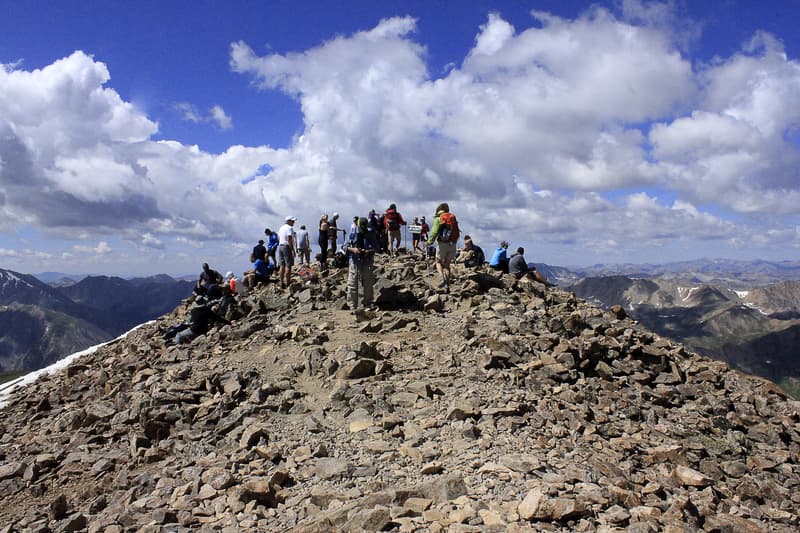
1. Longs Peak - Keyhole Route
- Distance from Denver: 105 minutes; 70 miles
- Locale: Rocky Mountain National Park wilderness
- Type: Class 3 (scary) 14er
- Objectives: Tame the beast. This is one of the hardest 14ers that you can climb without technical gear. The views are astounding, the hiking is mildly terrifying, and the trip is an adventure. Chasm Lake is accessible from the same trailhead. Be very careful, as many people have died on Longs. As with all hikes, but especially here: Do your homework so you don’t get in over your head.
- Length: 15 miles roundtrip, 5,100 feet. This is a Class 3 hike, meaning it includes segments of scrambling rather than walking.
- Trailhead address: East Longs Peak Trailhead, Longs Peak Road, Estes Park, CO
- More info: 14ers.com
2. Mt. Elbert
- Distance from Denver: 2.5 hours; 111 miles
- Locale: Sawatch Range, San Isabel National Forest, southwest of Leadville
- Type: Class 1 14er (via northeast ridge)
- Objectives: Bag the tallest mountain in the state. It’s one of the easier 14ers, but it’s still an intense hike with all of the weather risks and other concerns that come with alpine terrain in Colorado.
- Length: 10 miles out-and-back on the northeast ridge route, 4,700 feet vertical
- Trailhead address: Mt. Elbert Trailhead Parking Lot, Twin Lakes, CO
- More info: 14ers.com
3. Grays + Torreys
- Distance from Denver: 80 minutes; 54 miles
- Locale: I-70 corridor, Arapaho National Forest
- Type: Class 2 double 14er
- Objectives: Two peaks for the price of one -- well, for the price of about 1.2. The peaks are separated by a short saddle. This is one of Ashley’s favorite 14ers.
- Length: 8.4 miles loop/lollypop
- Trailhead address: 3025 Stevens Gulch Rd, Silver Plume, CO 80476
- More info: ProTrails
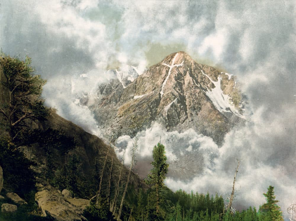
4. Mount of the Holy Cross
- Distance from Denver: 144 minutes; 112 miles
- Locale: Sawatch Range, Holy Cross Wildreness in White River National Forest, south of Minturn
- Type: Class 2 14er, 5,600 feet of vertical
- Objectives: A slightly more remote climb, and one of the shortest 14ers, with spectacular views and a variety of terrain on the way up.
- Length: 12 miles out-and-back
- Trailhead address: Forest Road 707, Red Cliff, CO
- More info: 14ers.com
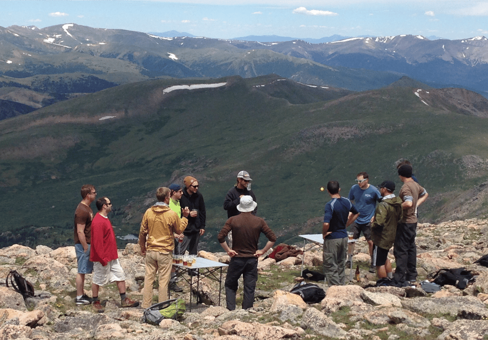
5. Mt. Bierstadt
- Distance from Denver: 75 minutes; 55 miles
- Locale: I-70 mountain corridor
- Type: Class 2 14er
- Objectives: Love the hike or hate the crowds, we had to include one of the most accessible and most hiked 14ers in Colorado. One of our staff members witnessed a group of guys playing beer pong on top of Bierstadt. Nonetheless, it’s a fun and beautiful hike.
- Length: 7 miles, 2,400 feet of vertical gain
- Trailhead address: Guanella Pass Trailhead, CO 381, Idaho Springs, CO
- More info: Day Hikes Near Denver
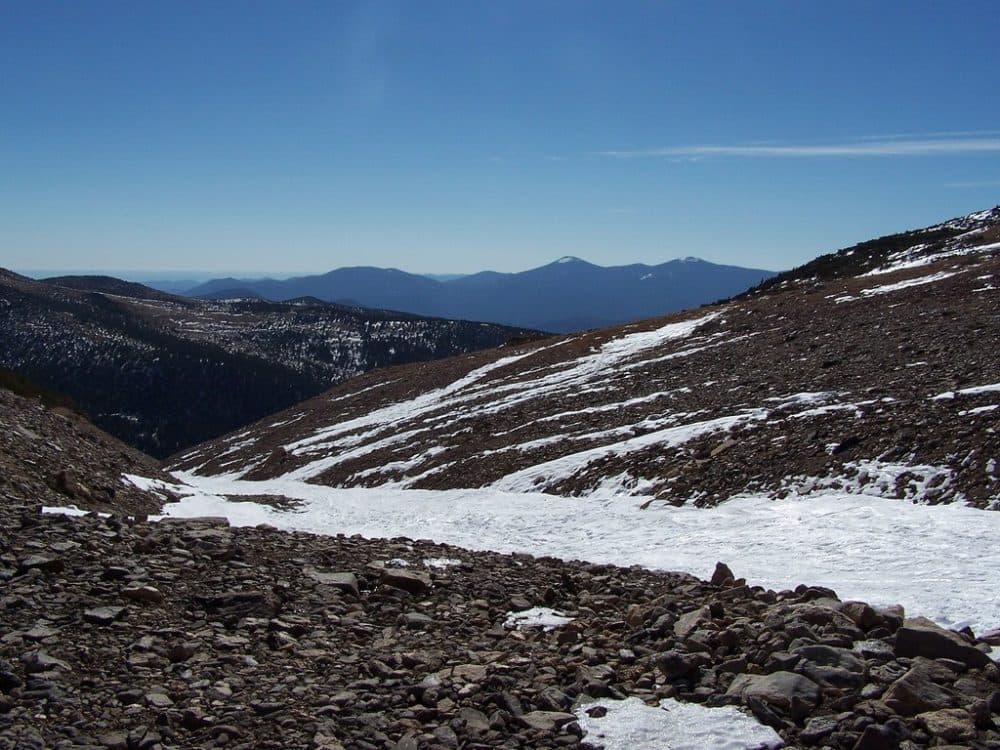
6. James Peak via St. Mary’s Glacier
- Distance from Denver: 1 hour; 43 miles
- Locale: I-70 mountain corridor
- Type: 13er
- Objectives: Hike alongside St. Mary’s Glacier before taking a somewhat tricky trail to one of the summits above. Don’t get lost!
- Length: 8.3 miles out-and-back, 2,900 feet of vertical gain
- Trailhead address: Parking is $5, cash. St. Mary’s Glacier Trailhead, Fall River Road, Idaho Springs, CO
- More info: ProTrails
7. Pawnee Peak
- Distance from Denver: 90 minutes; 60 miles
- Locale: Indian Peaks Wilderness via Brainard Lake
- Type: 12er
- Objectives: Claim one or two 12ers for a new view of Brainard Lake and the surrounding maze of mountains. Shoshoni Peak is also in the area.
- Length: 9 miles roundtrip, 2,100 feet of vertical
- Trailhead address: Access is $11 per vehicle and the road is closed through June 28, 2018. Brainard Lake Recreational Area, Brainard Lake Road, Ward, CO
- More info: ProTrails
8. Bison Peak
- Distance from Denver: 2 hours; 90 miles
- Locale: Lost Creek Wilderness, southwest of Denver
- Type: 12er
- Objectives: Conquer a strange, brutal and convoluted granite mountain with a long hike in relative solitude with a lot of uphill.
- Length: 12 miles, 4,000 feet
- Trailhead address: Ute Creek Trailhead, 9814 Tarryall Road, Jefferson, CO
- More info: Hiking Project, Summit Post
FOOTHILLS DIVISION
Long & Tough Conference:
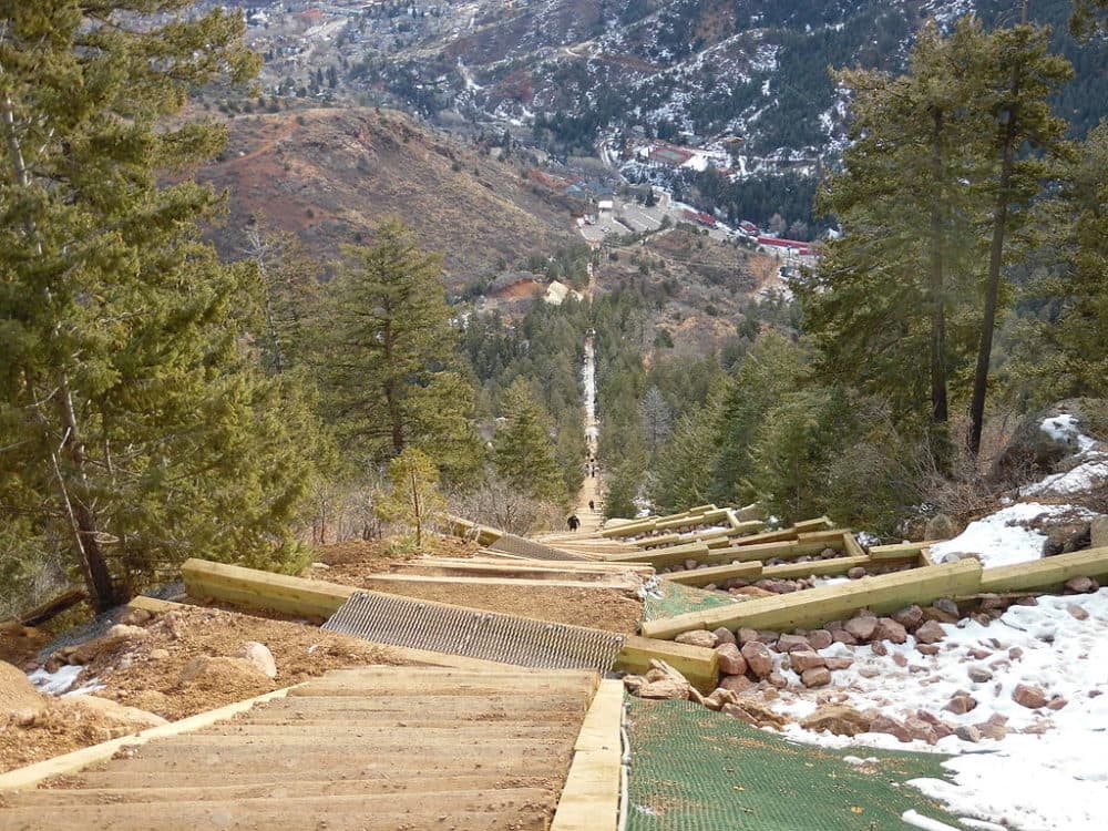
1. Manitou Incline
- Distance from Denver: 90 minutes; 75 miles
- Locale: Colorado Springs
- Type: Brutal staircase
- Objectives: This one’s farther than most of our foothills options, but we had no choice: It is a prince in the land of stupidly difficult trails, with an average grade of 41 percent and some 2,700 steps. You’re advised to come down via the alternate access trail.
- Length: one mile one-way, 2,000 vertical feet
- Trailhead address: The Incline, 506-538 Ruxton Avenue, Manitou Springs, CO. Bring $10 to park, just in case.
- More info: The Outbound
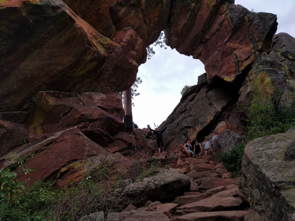
2. Royal Arch Trail
- Distance from Denver: 45 minutes; 29 miles
- Locale: Boulder foothills
- Type: Steep and short
- Objectives: It’s crowded as heck, but it comes with great views of Boulder and convenient access to summer patio breakfast, brunch or beers at Chautauqua.
- Length: 3.2-mile loop, 1,400 feet vertical
- Trailhead address: Chautauqua Park,, Baseline Rd. & 9th St. Boulder, CO
- More info: ProTrails
3. South Boulder Peak Trail
- Distance from Denver: 35 minutes; 28 miles
- Locale: Boulder foothills
- Type: Strenuous uphill
- Objectives: Climb through a shady canyon to one of the highest points near Boulder -- and maybe get your butt kicked.
- Length: 7 miles out-and-back, 3,000 feet elevation gain
- Trailhead address: South Mesa Trailhead, 3633 Eldorado Springs Dr., Boulder, CO
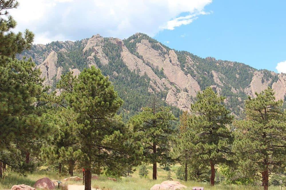
4. Green Mountain Loop
- Distance from Denver: 45 minutes, 29 miles
- Locale: Boulder foothills
- Type: Busy but not bustling, with a fairly intense climb
- Objectives: This hike will bring you high enough to get a look at the mountains to the west, and it also features an interesting map of those peaks.
- Length: 5.7 miles, 2,800 feet vertical
- Trailhead address: Gregory Canyon Trailhead, Gregory Canyon Rd., Boulder, CO
- More info: AllTrails

5. Carpenter Peak at Roxborough State Park
- Distance from Denver: 45 minutes; 26 miles
- Locale: Southern metro foothills
- Type: Moderate-to-strenuous climb
- Objectives: Get a new perspective on some red rocks that ain’t Red Rocks. Try the South Rim Trail for a lower-key hike.
- Length: 3-mile loop, 960 feet vertical
- Trailhead address: Roxborough State Park, 4751 Roxborough Dr, Littleton, CO 80125
- More info: Day Hikes Near Denver
6. North and South Table mountains
- Distance from Denver: 20 minutes; 15 miles
- Locale: Lakewood foothills
- Type: Wide-open mesas
- Objectives: Get some vertical on Denver’s doorstep! The Table mountains are an ideal place to knock out some training miles and get incredible views of the metro.
- Length: Variable
- More info: AllTrails
7. Centennial Cone
- Distance from Denver: 45 minutes; 26 miles
- Locale: Jefferson County
- Type: Strenuous foothills
- Objectives: Take a long and hopefully lonesome loop around one of the more prominent geological features above Denver. Constant terrain change makes for interesting hiking, although the lack of shade can be punishing. Be aware that Elk Range Trail, part of this loop, is closed through June 15. Also, the trail is only open to hikers on odd-numbered days of the month; the other days are for bikers.
- Length: 13 miles, 2,100 vertical feet
- Trailhead address: Mayhem Gulch Trailhead, 32447 US 6, Golden, CO. You can also use Centennial Cone West or North trailheads.
- More info: AllTrails
8. White Ranch - Outside Loop
- Distance from Denver: 30 minutes; 19 miles
- Locale: Jefferson County foothills
- Type: Rugged hills
- Objectives: Combine trails into a long loop over sunny hills and valleys. Beware that you may be significantly exposed to the sun and the weather, and there may be lots of bikers.
- Length: 13 miles for the outer loop; 3,000 feet of vertical
- Trailhead address: White Ranch Park East Trailhead, 21827 W. 56th Ave., Golden, CO
Accessible & Easier Conference
1. Waterton Canyon
- Distance from Denver: 34 minutes, 22 miles
- Locale: Southwest Denver
- Type: Convenient and accessible.
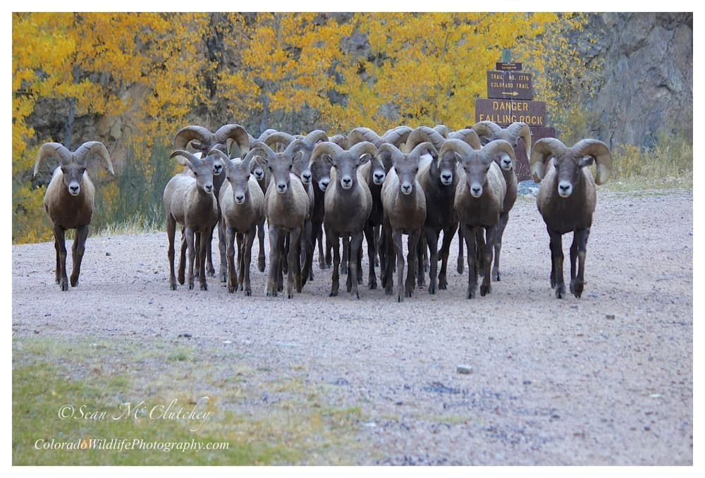
- Objectives: Run, walk or roll up a wide and well-maintained dirt road along the South Platte River. The road includes restrooms at the beginning and at one point along the way. Keep an eye out for bighorn sheeps.
- Length: 14 miles out-and-back, 600 feet vertical, but you can stop early
- Trailhead address: Waterton Canyon Trailhead, 12437-12489 Waterton Canyon, Littleton, CO 80127
- More info: Hiking Project
2. Meadow & Forest Loop Trails
- Distance from Denver: 30 minutes; 19 miles.
- Locale: Golden foothills
- Type: Convenient and kid-friendly.
- Objectives: An easy stroll that can be a kid's first hike, ending with a little time in the family-friendly Lookout Mountain Nature Center.
- Length: 0.6 miles or 0.8 miles, 141 feet vertical
- Trailhead address: 910 Colorow Rd, Golden, CO 80401
- More info: AllTrails
3. Wilderness on Wheels
- Distance from Denver: 75 minutes, 60 miles
- Locale: U.S. 285 southwest of Mt. Evans, near Kenosha Pass
- Type: Accessible boardwalk through the hills
- Objectives: Experience a trail that is specifically designed for people who use wheelchairs and other adaptive devices. It winds through woods and wetland tundra at 9,000 feet above sea level. Accessible camping sites, huts and cabins also are available. Tent sites and huts are free, while the cabins start at $55 a night. Find more accessible trails in our previous coverage.
- Length: 1 mile, with some uphill
- Trailhead address: 45954 US Hwy 285, Grant, CO 80448
- More info: Wilderness on Wheels
4. Bear Creek Trail at Lair O’ The Bear Park
- Distance from Denver: 30 minutes, 22 miles
- Locale: Jefferson County foothills
- Type: Shady creekside climb
- Objectives: Knock out a moderate trail within a reasonable distance of Denver. It’s more challenging than some other members of this conference, but switchbacks and shade make for a manageable hike. Also, what a great name.
- Length: 7 miles out-and-back, 1,200 feet vertical
- Trailhead address: Lair o’ the Bear Park, 22550 CO-74, Idledale, CO 80453
- More info: Day Hikes Near Denver or Hiking Project
5. Mt. Galbraith
- Distance: 30 minutes from Denver; 18 miles
- Locale: Golden foothills
- Type: Short and moderately easy hike.
- Objectives: Get outside quick and grab some great views. Bring plenty of water and sunscreen. This is a single-track dirt trail with a steady climb to it. Consider it for a trail run!
- Length: 4.3-mile lollipop, 900 feet vertical
- Trailhead address: Cedar Gulch Trailhead, 21992 Golden Gate Canyon Rd, Golden, CO 80403
- More info: Hiking Project
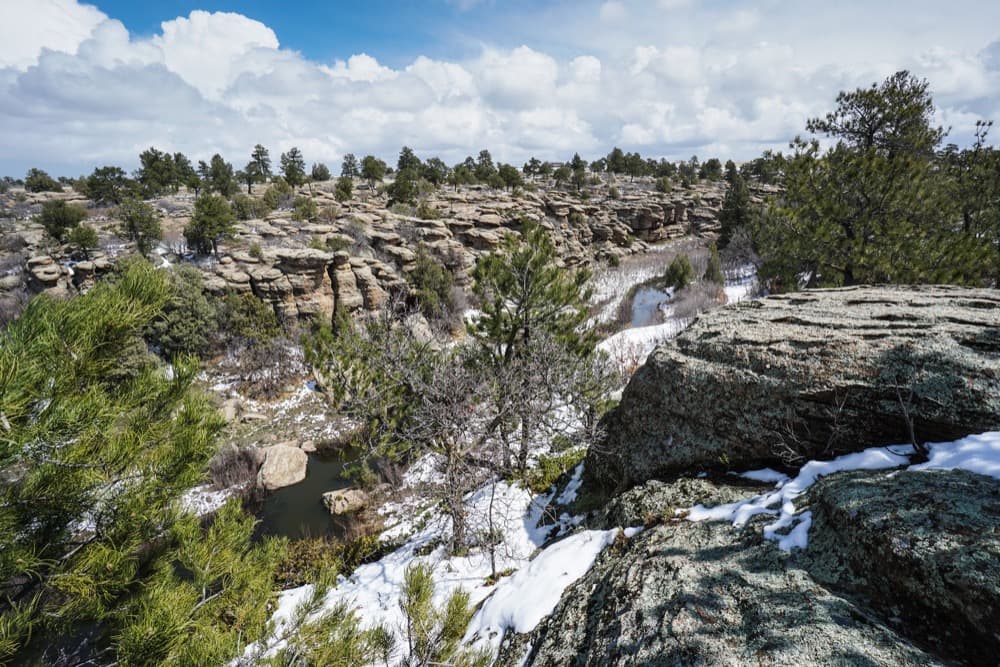
6. Castlewood Canyon
- Distance from Denver: 45 minutes, 42 miles
- Locale: Southern metro
- Type: Variable-length hikes with little elevation gain
- Objectives: Combine different trails into a winding walk through the unusual geology of Castlewood Canyon State Park. The fall colors are spectacular.
- Length: Up to 6 miles and 1,100 feet of vertical, but you can choose different trail combinations.
- Trailhead address: Castlewood Canyon State Park, 2989 S. State Hwy 83, Franktown, CO
- More info: GoHikeColorado
7. Bear Canyon Loop
- Distance from Denver: 40 minutes
- Locale: Boulder foothills
- Type: Convenient and accessible.
- Objectives: Stroll around rolling meadows with sweeping views of the Flatirons. This will keep you busy for at least an hour if you’re hiking, and it’s near the National Center for Atmospheric Research. Beware that you’ll be exposed to the sun. Longer, more difficult variants are available.
- Length: 3.5 miles, 400 feet vertical
- Trailhead address: NCAR Trailhead, 1850 Table Mesa Dr., Boulder, CO
- More info: Day Hikes Near Denver for the short loop, AllTrails for a longer variant
8. Elk Meadow
- Distance from Denver: 36 minutes, 25 miles
- Locale: Foothills
- Type: Easy loop trail.
- Objectives: Explore a collection of historic homestead parcels, looping an easy trail through the meadows amid the ponderosas. Keep an eye out for elk.
- Length: 4 miles, 600 feet of vertical
- Trailhead address: Elk Meadow Park, 2855 Bergen Peak Dr., Evergreen, CO 80439
- More info: ProTrails
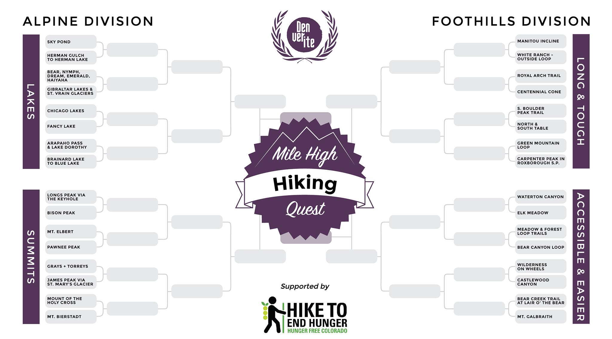
The brackets:
We have horizontal and vertical versions of our bracket. Follow along as we march through the rounds!


