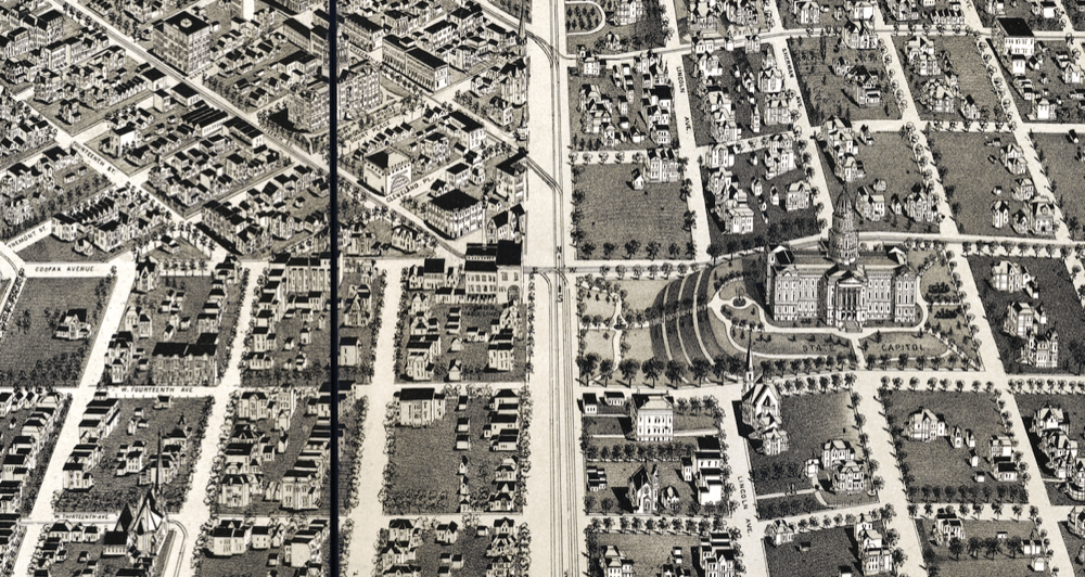
Last week, we took an aerial tour of Denver circa 1889 with the help of a gigantic illustrated map. I knew we had only scratched the surface — this thing is detailed down to houses and trees — but I quickly learned that I had missed one of the map's most interesting features.
Within an hour of publication, a reader pointed out that the Capitol is facing the wrong direction on the map.
How did a map with so many details screw up such a huge one? Because the Colorado State Capitol didn't really exist at the time. The map was published in 1889, while construction happened in the 1890s.
I'm not sure why exactly the mapmaker here got the Capitol's orientation wrong. I've put some calls out to historians and will update if I get a definitive answer — but the most likely explanation is that the blueprints were still in flux at the time of drafting, and the master plan for the broader Civic Center area wouldn't emerge until 1917.
The full, browsable map is available here. Let me know what else you find: [email protected].