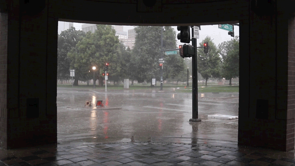
The National Weather Service has issued a flash flood watch for the Denver metro area, the Front Range and the nearby plains from noon through the evening.
"Numerous thunderstorms will develop this afternoon over the foothills and Palmer Divide then shift eastward across the I-25 corridor and adjacent plains late this afternoon and evening," the NWS reports. "The airmass will remain very moist and become increasingly unstable with afternoon heating. The slower moving storms could produce very heavy rain with the potential for flash flooding. The stronger storms could produce up to 2 inches of rainfall in less than one hour, and up to 4 inches of rainfall in two to three hours if a storm becomes stationary."
What's the difference between a flood watch and a flood warning?
A flash flood watch means conditions are favorable to flooding. So, it could happen and you should be prepared.
A flash flood warning would mean that a flash flood is imminent or already happening.