Denver, we found your awkward photos from the '80s. A new tool from Google and Carnegie Mellon allows users to browse around a giant time-lapse video of the entire world spanning 1984 to 2016. We picked out some prime spots where the project captured Denver's rapid changes.
If the images are changing too quickly for you, there's a speed toggle on the lower left of each time-lapse. Also, be warned that this doesn't seem to work on mobile.
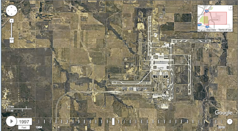
A baby airport is born:
Here we see Denver International Airport rise on the eastern plains.
And an old airport dies:
Here we see Stapleton International Airport turning into a residential neighborhood.
Southern sprawl:
Here's the view of eastern Centennial and a bit of southern Aurora. You can see E-470 plunge through right after the millennium, and immediately it spawns new development in the far southeastern corner of the metro. You can also see the Aurora Reservoir form in 1989.
The Boulder greenbelt:
Boulder's "greenbelt" has kept the city's shape roughly the same for decades. You can see below how the city's purchase of open space has kept a strip of green around Boulder since 1984 -- but, combined with the city's reluctance to build higher, it also has contributed to very high housing prices there.
Downtown:
Unfortunately, these images are too blurry to see much detail -- but I did spot Mile High Stadium popping out of the ground mid-frame around 2000. You can also see the South Platte River's banks being redeveloped to the northeast from a desolate train yard to a luxury apartment neighborhood.
Golden creeps up the valley:
Mountain town and a mine:
Here you can see Central City Parkway punch through from Black Hawk to meet Interstate 70 while a new mine spreads into the mountains.
The fields are LEDs:
The area west of Great Sand Dunes looks like some weird display to me.
The time-lapse engine is available here. Use the share button to send me the best ones you find: [email protected].