Here's a short story about two places with long names: Sports Authority Field at Mile High and Sports Authority Field at Mile High Station.
The light-rail station is less than half a mile from the football stadium. It's incredibly convenient, in theory -- but the distance between them is a perfect illustration of an issue that may be holding back Denver's transit and pedestrian networks from their full potential.
We're going to dive in with some planning experts and explain it all in just a few minutes, with Mile High as our lens, and then talk about a few ways the city might address this issue soon.
Imagine you're leaving Mile High in the third quarter of a Broncos game.
The Broncos are losing and you're sloppy drunk. You got a ride here with a friend, but she doesn't want to leave, so you're planning to walk to the station and catch a train.
So, first step, maybe you look up "Mile High Station" on Google Maps. Well, that's a bar. Not what you need.
This can be a real problem: I've run into two utterly confused people on my runs through the area. One of them was even ready to start walking down the river, which would have put him nowhere but the dark for a couple miles. I was able to point them in the right direction with my phone, but I'd never made the walk myself until Wednesday.
To simulate the journey, I called up Gosia Kung, founder of the nonprofit WalkDenver, and made her try to find the station.
Coming out of Gate 1, we found signs for gates, parking and the Colorado Sports Hall of Fame -- but not the light rail station, which sees a huge spike on game days, according to RTD.
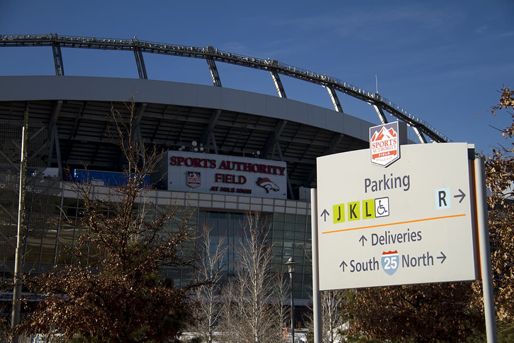
"Trying to find a way out of here and look for a light rail station, there’s no indication where to go," Kung said.
So we started walking around Mile High. We had made it 20 minutes and nearly 180 degrees around the stadium before we finally found a map. The map – not a large one – told us that the RTD station was on the other side of the South Platte River. It didn't include the roads or walkways near the station.
"How do you get there?" Kung asked. "It's kind of out in space. It ... doesn't seem like there's any connection to it."
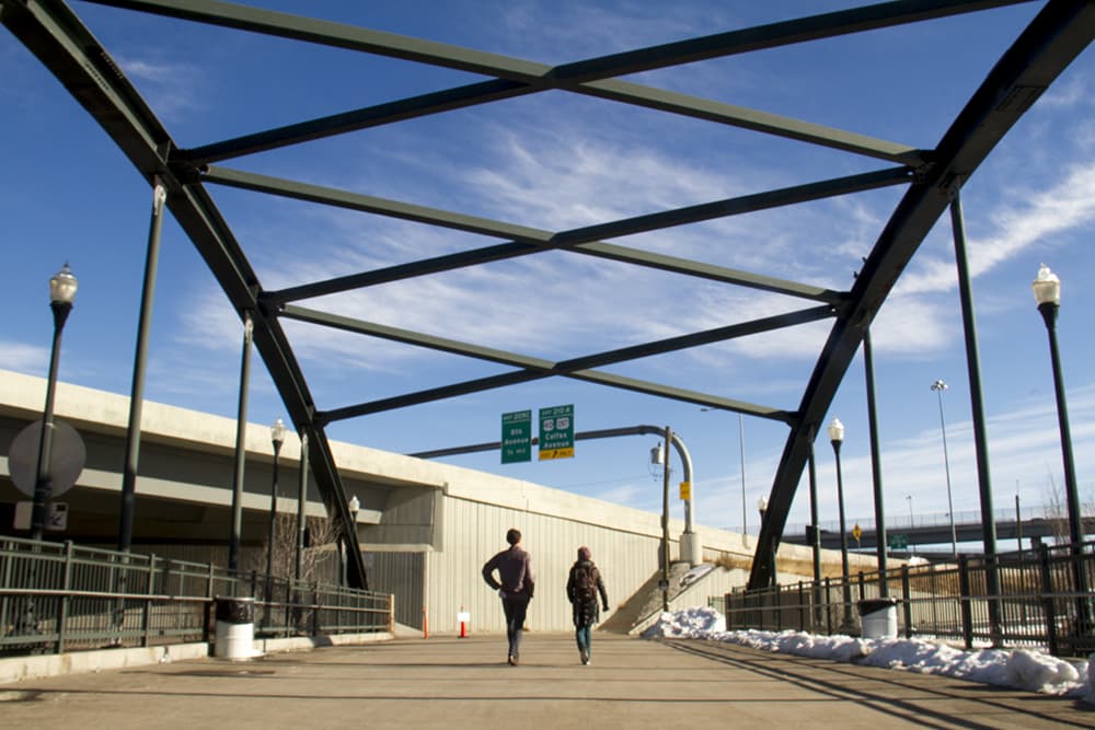
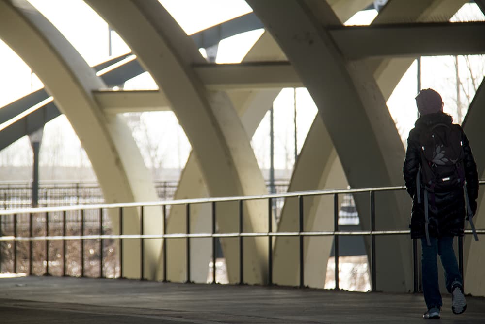
Eventually we found a sign pointing us across a pedestrian bridge over the South Platte River – and straight into a T split with no indication of which direction to go.
A few minutes of adventurous and undirected walking under four of five highway overpasses finally put us at our destination: Sports Authority Field at Mile High Station. It probably took us 25 minutes to get there, more than twice what it should have.
Got a location you'd like to highlight as extra confusing? Let us know at Facebook.com/Dnvrite.
This happens all over the Front Range.
Denver and its neighbors have been building systems of bike lanes and greenways for some 40 years. At this point, you can travel between many of the region's cities without touching a street for miles upon miles.
Those trails and lanes are scattered with a few maps, but you'll rarely see signs that clearly describe where you're going and where each turn leads.
Even Denver's Union Station, the heart of its transit and trail networks, has practically no signage toward any of the bike trails or the nearby riverine routes, according to Gabriella Arismendi, a transportation and mobility planner who works in the region.
"If somebody is trying to get to the Cherry Creek Trail, there is nothing that is telling them," she said. "That’s one of our major bicycle, bikeway spines here in the city."
Around the region, "there’s signage that’s designed for cars, telling you where to go, where to turn," Kung said, "but the pedestrian and bike signage is just something relatively new. We haven’t talked about it until very recently."
In Denver, Kung said, some of the few pedestrian/cyclist wayfinding signs are on West Colfax, where they were erected by the local business improvement district in conjunction with Denver Public Works.
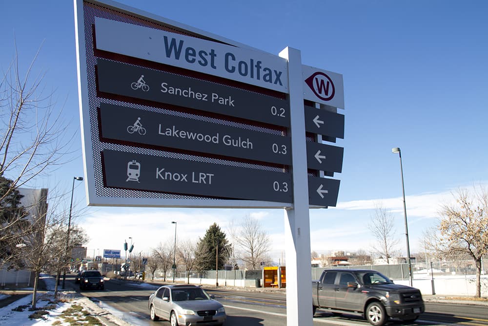
These signs are pretty simple, listing directions and distances for a few key destinations. The idea is that good signage can encourage people to explore, and it can explain some of the hidden benefits of all the investments the city has made.
"The easier you make it for people to go from Point A to Point B, the more that you’re going to use it," Arismendi said.
There are a few reasons good signage is hard to do.
"It’s a science. It’s a behavioral science," said Arismendi. "... It’s trying to figure out exact placement of where those signs need to be located and then the cost of manufacturing all those signs."
It can also come with a lot of bureaucracy. At Mile High, for example, you've got to find a design that's both amenable to the Broncos management and effective in getting people around.
An earlier, temporary project in Jefferson Park even ran into questions about light-pole ownership and tariff law.
"It sounded like a huge bureaucracy against a small, 12-inch-by-12-inch plastic sign," Kung said.
Some change may be coming, though.
Denver Public Works has been pushing to install more wayfinding signs near bike lanes since 2014, and they're now including them when they do bike-related projects.
There's also a sizable new opportunity to address the issue: Denver's in the middle of a project that will set the plan for its bike and pedestrian networks for many years to come. Denver Moves is part of the larger Denveright planning process that also looks at parks, transit and land use.
Specifically, the plan "will address wayfinding signage for trail users to help connect them to Denver’s regional trail network," according to Heather Burke, spokeswoman for Denver Public Works.
The city also will be working in 2017 on a plan to install signs for pedestrians to get around downtown Denver, along with new wayfinding signs for transit stations. The downtown project eventually will become a model that neighborhoods could adopt.
Westminster also is experimenting with wayfinding, as are 36 Commuting Solutions and Jefferson County, among others.
In the meantime, you Denverites can sound off on bike and pedestrian access at the page for Denver Moves: Pedestrians & Trails.
Want to keep up on Denver transit news and more? We've got a newsletter. I also tweet out a morning news roundup at twitter.com/andyknny.