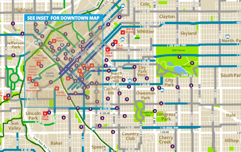
Denver has a sprawling network of greenways and a handful of protected bike lanes, not to mention bike routes and sharrows.
I've previously navigated them using Google Maps' biking overlay (here's how to do that) but I recently learned that the city provides hard-copy maps, which I find are really helpful for understanding an area.
You can find the 2017 edition of the bike map online and print it out yourself, or it's available in print at these places:
- All Denver recreation centers
- City and County Building: 1437 Bannock Street, Room 385 or Room 451
- BikeDenver: 3000 Lawrence St. Suite 212
(It's worth noting that the 2017 map doesn't include the Broadway bike lane, probably because it's still not permanent.)
Also helpful is BikeDenver's map of the bike routes. These are not bike lanes, but they are recommended routes that combine streets, lanes and greenways.
Correction: This story listed a previous address for BikeDenver.