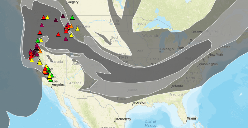
As wildfires continue to burn across the western United States and Canada, Denver can't seem to catch a break from the smoke, according to a map on an Environmental Protection Agency website.
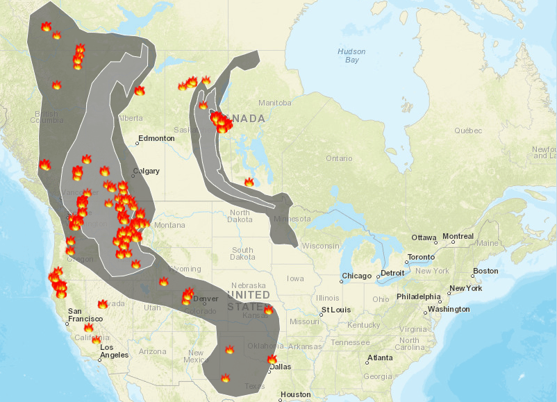
Though it's cleared up for most of the country, including southern Colorado, since the majority of the mainland states were blanketed on Tuesday, Denver still sits directly in the path.
Here's Tuesday's AirNow map for reference:
The Front Range is still under an ozone alert, meaning “unusually sensitive” people should take it easy.
As you can see from the terrifying little fire markers on today's map, most of the smoke is coming from huge fires in the Pacific Northwest and California. But Colorado has it's own fires contributing to the haze.
Heavy smoke has led to the cancelation of some outdoor events in Steamboat Springs, according to Steamboat Today.
The Associated Press reports: The Deep Creek Fire was reported Monday and has spread to about 3.6 square miles (9.2 square kilometers). To the north, the 2.2 square mile (5.7 square kilometer) Big Red Fire has been burning toward the Mount Zirkel Wilderness Area.


