It turns out a children's library isn't just suitable for kids hoping to find an escape between pages. It's also a suitable place for adults to learn about zoning.
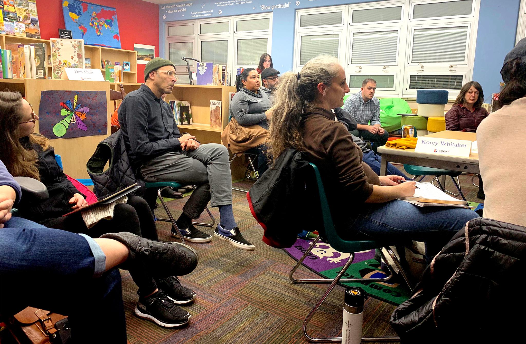
On Thursday evening, more than 20 people crammed into colorful chairs at Cowell Elementary School to learn the basics of Denver's zoning laws and land use. It's the beginning stage of the West Area Plan, a guiding document for the future of six westside neighborhoods including Barnum, Barnum West, Sun Valley, Valverde, Villa Park and West Colfax. The document is part of the city's Neighborhood Planning Initiative, which means to ensure every neighborhood has a plan for growth.
The team of 20 comprises the plan's steering committee, a group of voices that rep different corners of the westside. City Planner and project manager for Eugene Howard said each neighborhood gets three representatives. It's all part of an 18-month process that will culminate with a Denver City Council vote on the plan.
Their job sounds simple enough: Provide thoughts and opinions to the city's planning department from the perspective of their neighborhood in order to craft the 20-year guideline for growth and development.
Okay, so maybe not that simple.
"I think this meeting was helpful for understanding the code, that's existing, and seeing how it plays out," said Barnum resident Jennifer Piper, who wandered around the city renting before settling in her current neighborhood 11 years ago.
She wants the neighborhood to remain working-class, the kind known for its "entrepreneurial spirit."
"This city is really important to me," Piper said. "I want to bring all my neighbors' voices to this process."
The West Area Plan won't change zoning laws, but it will recommend them.
Still, Howard said Thursday's meeting should provide a basic framework for how zoning works in the city. Attendees saw maps of the area's topography, employment concentration, existing building use for the area and a historic breakdown of when buildings were erected.
Committee members learned that this area, with a population of roughly 42,000 people, has grown by about 19 percent between 2010 and 2018, with West Colfax leading the way. That neighborhood has grown 43 percent, compared to a 21 percent growth rate citywide during that span.
They learned the area is home to lots of single-family residential units -- or as normal people call them, houses -- with more mixed-use and industrial buildings closer to the South Platte River. Some homes in this area were built before 1900, back when farms in the area were commonplace. Becca Dierschow, a city planner with the city's preservation office, detailed the area's history and why you can find Victorian-era farmhouses (built pre-1900), craftsman bungalows (1901 to 1925) and minimal traditional houses (1920 to 1945) throughout these neighborhoods.
The volunteers even learned how a single property can be zoned, which translates to how a neighborhood looks and feels.
Howard walked them through the process behind turning a parcel into a home, starting with a blank space that's slowly whittled down with rules about things like height and how far a home should be set back from the street. The planning geeks call this a "building envelope." Every home must fit within this phantom, geometric structure to comply with zoning laws.
"You add a fence, some trees, and you're starting to make a neighborhood," Howard said.
There were also things committee members did not learn but would like to. Many wanted more information about jobs in the area -- one person wanted to know what percentage were related to the cannabis industry -- which is information Howard said will be coming soon, once a market analysis is completed. Housing density wasn't talked about too much, but it was another item on the committee's to-do list.
District 3 Councilwoman Jamie Torres sat alongside committee members and asked questions during the roughly 90-minute meeting. A majority of the neighborhoods in the plan are in her district, though there are portions in District 1 (parts of West Colfax) and District 7 (Valverde).
"What I hope the steering committee gets out of these meetings is what a plan gives residents as a tool," Torres said. "When we're looking at it from the city's side, it's one of the significant factors for what gets built, how do things change, how do things evolve over time."
Torres said Piper brought up an interesting point during Thursday's meeting -- getting between the neighborhoods. Connectivity is something Torres is interested in learning more about, as well as the kinds of things each committee member wants to see in that realm.
Before they left, Howard gave everyone homework. He asked them to photograph three examples of a house no taller than 30 feet, or 2.5 stories. Howard wants them to continue considering what kind of land use would make sense in their neighborhoods over the next 20 years.
The group's next meeting is Dec. 19 at the Avondale Apartments on West 14th Avenue.