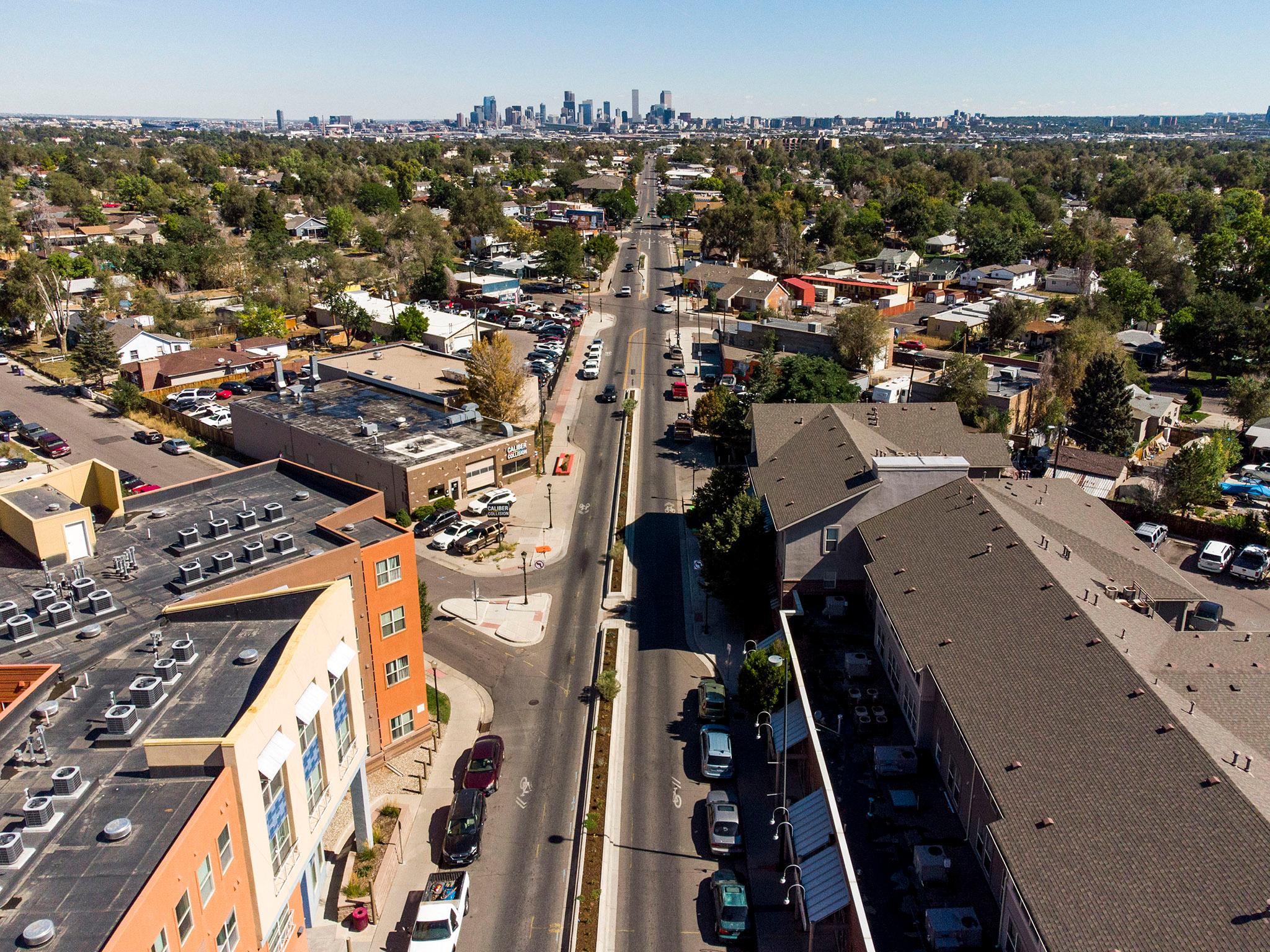
Morrison Road bisects almost the entire Westwood neighborhood in Southwest Denver. As the city has grown around the thoroughfare, it remains a single slanted line in a sea of north-south grids.
A number of different factors have created Denver's diagonal streets. The orientation of natural features like the Platte River and Cherry Creek, for example, gave downtown Denver and Auraria their 45-degree angles.
The influence of the City Beautiful movement, which focused on grand civic centers and parks, prompted the creation of streets like Park Avenue to connect downtown to different open spaces. Tom Noel, a Colorado historian and professor at CU Denver, said the idea of those diagonal roadways is borrowed from Paris. In the ultimate City Beautiful, roads all point to the city center, creating a star-shaped city.
But none of these things happened with Morrison Road.
"Morrison road was, in fact, as its name suggests, the road out to Morrison," Tyler Gibbs, Denver's former urban design director, explained. People were just trying to get in and out of the city fast.
It was the first route into the city from the south, according to an Urban Land Institute report from 2013. And although stretches have been lost, pieces of the rest of Morrison Road can still be seen out past Wadsworth Boulevard.
A few other things set Morrison Road apart.
Unlike other diagonal streets in downtown, Morrison's alleyways aren't in line with the street. That's because Westwood's grid slowly filled in around the main thoroughfare. Westwood began as an unincorporated shack town during the Great Depression. Its population surged again in World War II, and the neighborhood was finally incorporated in 1947.
The neighborhood's small blocks now intersect Morrison Road at odd angles, leaving little triangles of sidewalks and buildings and creating awkward, sometimes unsafe pedestrian crossings.
"You've got quite a variety of odd shaped lots depending on how they happen to lay out," Gibbs said. "So it's just not as consistent as most of Denver."
This creates issues with city zoning and code, since most of Denver's zoning assumes that businesses and homes have access to an alleyway where trash pickup can occur. That isn't always the case in Morrison's hodgepodge of blocks.
Unfortunately, the high speed limit on Morrison Road and prioritizing car traffic have kept the boulevard from being very pedestrian-friendly, but medians and pedestrian crossings have been incorporated over the years. Alameda, Sheridan and Federal, the roads that surround Westwood to the North, East, and West respectively, are all part of Denver's High Injury Network, or the 5 percent of streets where 50 percent of fatalities occur.
More improvements are slated to begin next year, according to Gibbs.