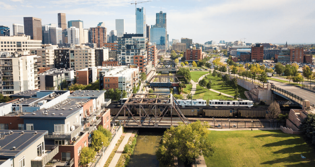
Downtown Denver’s population will likely more than double in the next couple of decades as tens of thousands of new residents move just west of LoDo and the Central Business District into the River Mile, Ball Arena parking lot and Auraria Higher Education Campus developments.
The planners’ dream is to create a massive, walkable live-work-play-learn community that builds on the successes of the current downtown.
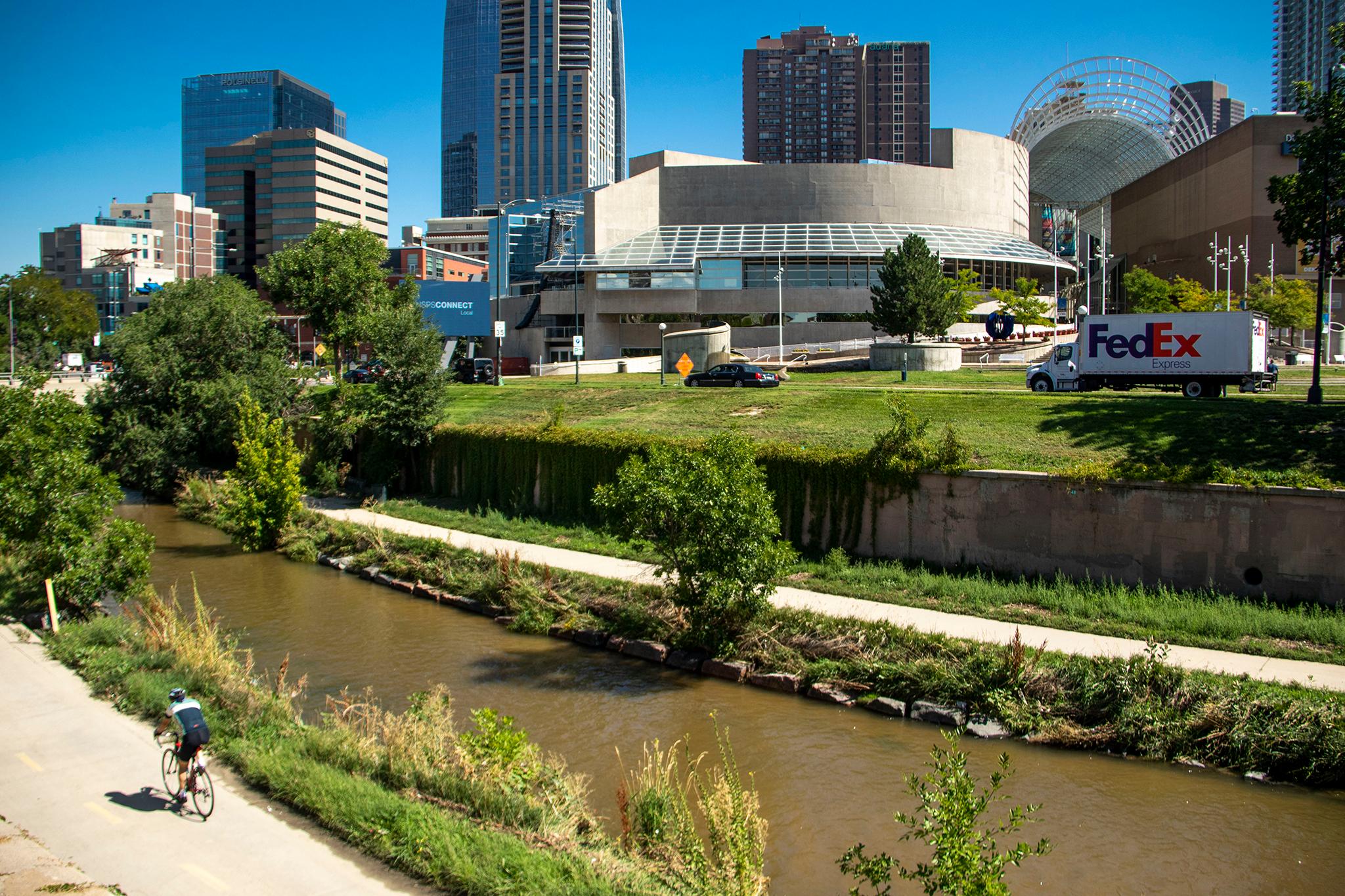
But for that to happen, there’s a big problem to fix: crossing Speer Boulevard, a roadway that sometimes feels more like an interstate than a boulevard. The road is designed for motorists and not everybody else.
Now the city is asking residents to take part in its Cherry Creek and Speer Boulevard Vision and Reconfiguration Feasibility Study to prep for any planning that might take place.
The questions at stake: Could the Speer Boulevard and Cherry Creek Trail corridor through central Denver, from Colfax Avenue to I-25, be better? If so, how? And is improving it actually doable?
For the past few years, the city, in partnership with the Urban Land Institute, has been looking at growth in the area and what needs to happen to make all these new developments work with Denver’s current downtown.
Speer and Cherry Creek are currently barriers between LoDo and the Central Business District and everything to the West. That’s not necessary, as urban planners see it.
Instead of serving as the edge of downtown, Speer and Cherry Creek could become a playground in the center of a newly imagined and expanded downtown area.
The city’s work was spawned by a 56-page report created by the Urban Land Institute about better connecting the Auraria Higher Education Campus and future developments at Ball Arena and the River Mile, along the South Platte River where Elitch Gardens currently sits, to downtown.
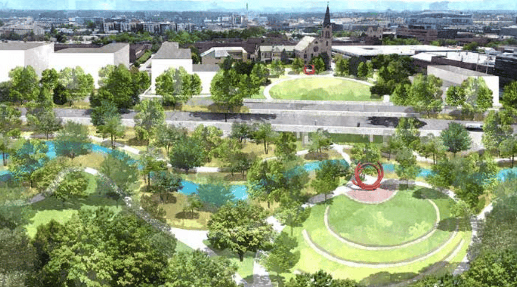
Among the short-term recommendations: “Explore changes to Speer Boulevard now. Intervene. Slow motorized traffic. Add dedicated bicycle lanes,” the report stated. “Kick-start enhanced safety and connectivity by reconfiguring Speer Boulevard with priority for crossing pedestrians and bicyclists.”
Ultimately, the Urban Land Institute wants to see the city turn Cherry Creek into “an improved environmental asset and recreational attraction for all Denver communities.”
So the city took action and is trying to figure out what’s actually wanted — and possible.
“This study aims to develop a realistic vision, vetted for technical and financial feasibility, to improve how people move through and experience this area,” explained Community Planning and Development online.
The idea is to improve public spaces, make both Cherry Creek and the trail more enjoyable, create activities for locals and tourists alike and improve connections between the Auraria Campus and Ball Arena and Upper and Lower Downtown.
“The study will also include community and stakeholder engagement to inform the design and engineering analysis and ensure that the vision for the corridor reflects the needs of those who live by and utilize the corridor,” Community Planning and Development wrote.
There’s no immediate construction to look forward to or dread. The city is just trying to get an idea of what people want to see for any future projects.
There are six big things the city is looking at with this study: environment; public spaces; recreation and culture; connections; inclusivity; and commerce and education.
“We want our natural environment to thrive and to satisfy Denverites’ desire for enjoyable outdoor spaces,” the planning department explains. “This includes improving the conditions of the Cherry Creek waterway, enhancing wildlife habitats along the corridor, bolstering vegetation, and increasing shade from trees.”
The city wants the area to boast more public spaces to lure people into enjoying nature in the city center.
The plan could include boosting recreation opportunities beyond the cycling and walking path and culture and entertainment beyond the nearby Denver Center for the Performing Arts.
“We will study how to improve access to and move people more efficiently and safely along and across the corridor, whether they are walking, biking, using public transit, or driving,” Community Planning and Development explains.
The city will also be trying to find ways “to improve access to and move people more efficiently and safely along and across the corridor, whether they are walking, biking, using public transit or driving.”
The project will honor and attempt to preserve the history of Cherry Creek and Speer Boulevard while expanding access to the area.
The city is looking for ways to boost access to commercial and educational opportunities between the soon-to-grow, not-yet-guaranteed parts of the city center and the existing downtown.
Here’s how to play your part.
The city wants you to fill out a survey to figure out the current conditions and big issues in the area and share ideas about what the corridor should look like in the future.
You’ll get to answer how frequently you travel on the Cherry Creek Trail and Speer, what modes of transportation you use, how often you use the corridor and what you like about it.
You’ll also have a say in what types of new perks the Speer and Cherry Creek Trail corridor needs. Are there things that would make the corridor work better for you? How safe does it feel? What activities or features would help bring the community together in the space?
So get busy here. You have until Oct. 29 to participate in the survey.
Here’s the timeline.
The study started in Spring 2023 and will wrap up in early 2024.
The city is currently “defining the challenges and crafting the vision,” a process that should wrap by the end of the fall.
Over the winter, the city will evaluate alternatives and develop final recommendations.
The report will be published early next year and possibly lead to the reimagining of this historic — and trafficky — corridor.